


Headlines
- RECORD HIGH POSSIBLE TUESDAY
- SEVERE THREAT NORTH TUESDAY NIGHT
- SEVERE CHANCE FOR MOST WEDNESDAY MORNING
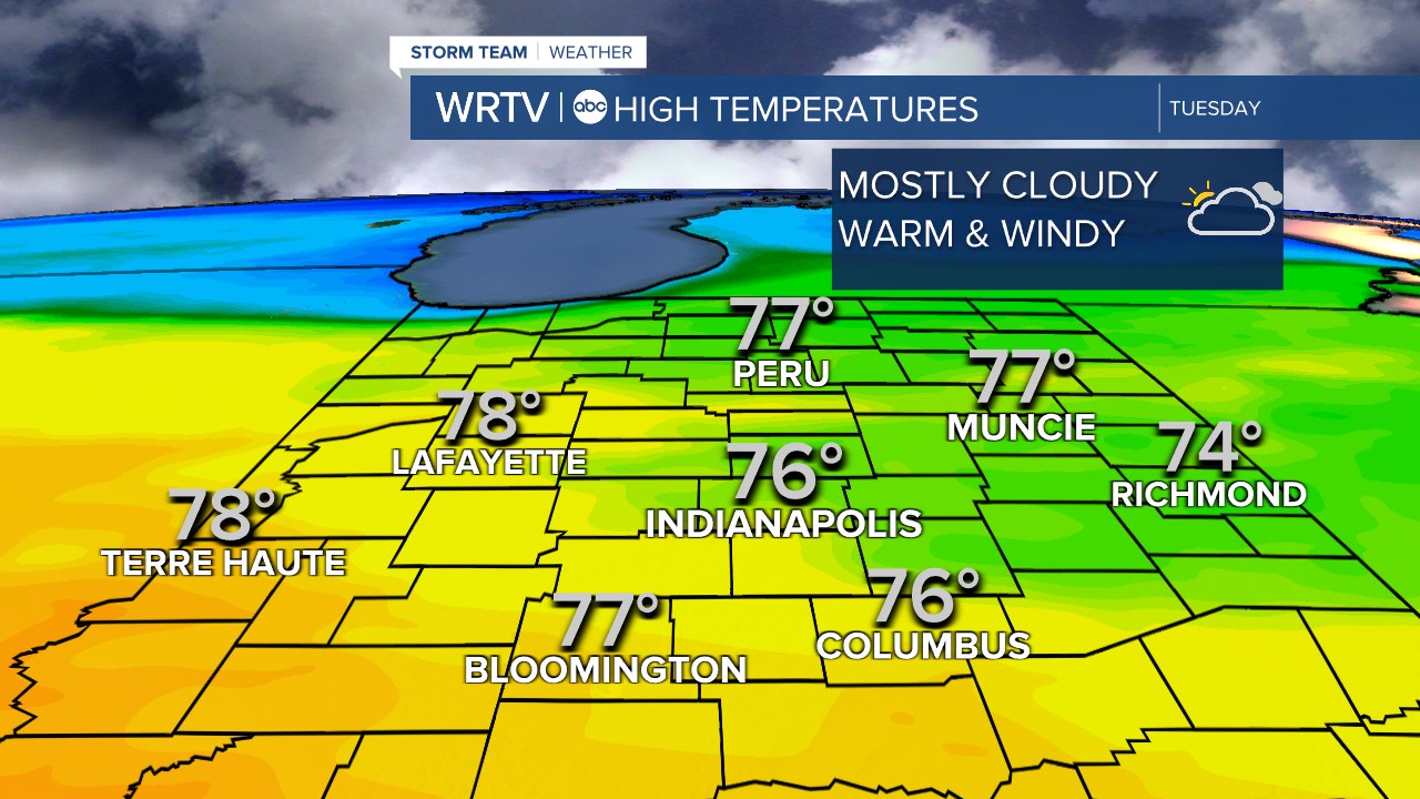
Tuesday will start off with some fog and possibly even some patchy drizzle. Once that clears, temperatures will warm and top out right around the record high of 74°. While an isolated shower or storm is possible during the day, most of us should remain dry. The severe threat will then ramp back up late Tuesday night in northern locations. So, don't cancel your daytime plans, but for those of you to the north, after about 7pm, you will need to be weather aware.

The Storm Prediction Center has most of the area under a slight risk category for Tuesday. However, this is primarily for the overnight hours into Wednesday morning’s commute. To the far northwest, there is an enhanced risk. This is the area that, Tuesday evening, will have the chance of large hail and tornadoes. This threat will be along the warm front, which will continue to move north and carry the severe threat into Michigan during the evening hours.

As that front sinks south, storm chances will increase for central Indiana heading into the morning commute on Wednesday. Here is what the radar could potentially look like.
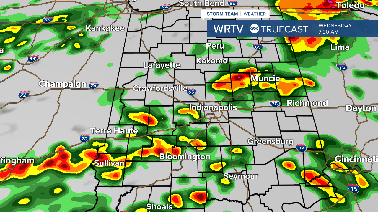
Parts of the area are under a marginal risk for severe weather on Wednesday. However, I think flooding might end up being the biggest concern, as the rain could be very heavy in some areas.

Stay with WRTV for all the latest.
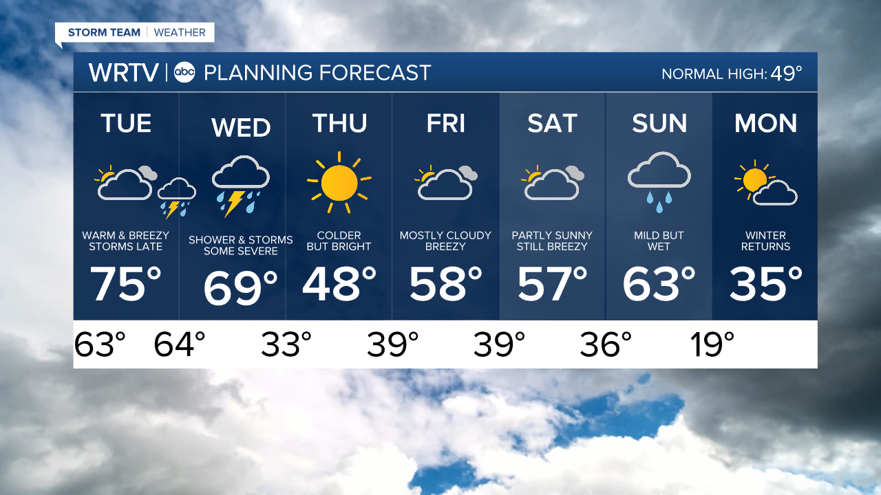
Indianapolis Weather Forecast:
Overnight: Mostly cloudy. Some fog/drizzle Low: 63°
Tuesday: Mostly cloudy & breezy. Some storms late High: 75°
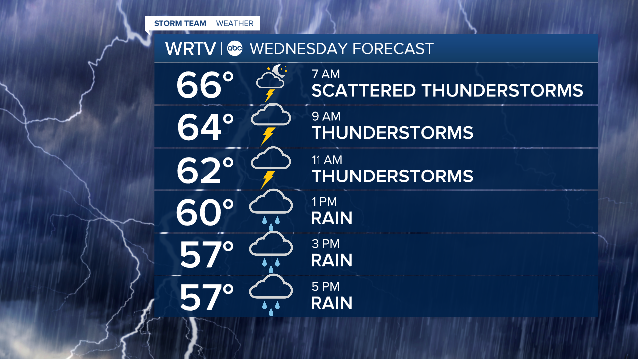
Wednesday: Rain & storms. Heavy at times. High: 69°
Thursday: Sunny but colder. High: 48°
Indianapolis 7-Day Weather Forecast