


Headlines
- DENSE FOG ADVISORY UNTIL 9AM TUESDAY
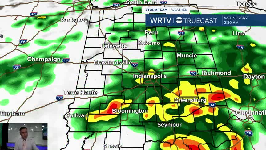
- WEDNESDAY POTENTIALLY THE WETTEST DAY
- WEEKEND LOOKS DRY AND WARMER
A Dense Fog Advisory in place for most of central Indiana until 9am Tuesday morning. School delays will be likely tomorrow morning for many as visibility could be next to nothing. The fog should burn off fairly quickly and leave us with a decent Tuesday. Just be careful overnight and for your morning drive.

Tuesday will bring isolated rain chances; however, most of the day should be dry, with partly cloudy skies and seasonable temperatures. The best chance of storms will be scattered in the afternoon hours.

Another wave of rain will come on Wednesday, which could potentially be the wettest day of the entire week. Some showers will linger into Thursday as well. An additional 1 to 2 inches of rain will be possible by Friday morning, especially south of Indy.

The good news is the weekend is looking great, with sunshine and highs in the low 80s.
Indianapolis Weather Forecast:
Overnight: Dense fog possible. Partly cloudy Low: 65°
Tuesday: Partly cloudy. Sct. storms. High: 78°
Wednesday: Fairly wet. Areas of rain. High: 73°
Thursday: Mostly cloudy. Areas of rain. High: 74°
Indianapolis 7-Day Weather Forecast

