


Headlines
- CLOUDS INCREASE BUT A DRY FRIDAY
- MARGINAL RISK FOR SEVERE STORMS SATURDAY
- WINDY & WET SAT PM - SUN PM
The new drought monitor was issued Thursday morning and shows continued moderate to severe drought north of Indy. There has been some improvement south of the area, where 1 to 3 inches of rain fell last week. Much-needed rain is expected this weekend as a powerful storm moves through the Midwest.

Before that storm arrives, Friday will be another pleasant day. We'll start with sunshine, but expect clouds to increase during the afternoon. Temperatures will once again be in the low to mid-70s.

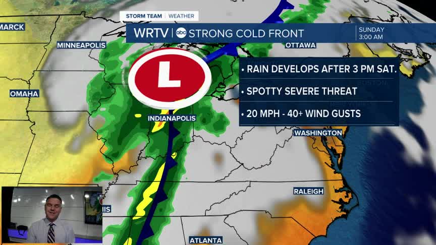
If you have plans on Saturday afternoon or evening, you will need to be weather-aware. Expect the threat of rain and storms anytime after 3 p.m. on Saturday. Before that, it will be dry, but you will notice the wind picking up as the day goes on. It will end up being a very windy stretch, even outside of any thunderstorms. Winds will likely peak late Saturday through early Sunday morning in the 40+ mph range.

The initial band of heavy rain will be where the threat of lightning and some strong to severe storms exists. The overall severe threat will remain south of Indiana, but a few isolated storms with strong winds are not out of the question. The Storm Prediction Center has placed us under a "marginal risk" of severe weather, which is the lowest threat level. Rain chances, although lighter, will continue overnight and throughout the day Sunday before tapering off in the afternoon.

Once the rain wraps up, many areas will see about 1 to 3 inches, with the higher totals occurring in places that experience the strongest storms.
Indianapolis Weather Forecast:
Overnight: Mainly clear Low: 49°
Friday: Sunny start. Increasing PM Clouds. High: 73°
Saturday: Windy. Rain and storms develop. High: 82°
Sunday: Rainy and breezy. Much cooler. High: 62°
Indianapolis 7-Day Weather Forecast

