


Headlines
- A DRY BUT COOL WEEKEND
- IN THE 40s SUNDAY AND MONDAY MORNING
- WARMING TREND NEXT WEEK
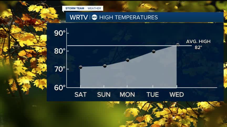
Any CLOUDS will move out on Saturday, and we’ll be left with mostly sunny skies by the afternoon. It will be cool, though, with high temperatures struggling to reach 70° both Saturday and again on Sunday.

If you are tailgating, heading to the Colts game, or have any other plans, you’ll need a jacket in the morning. Morning low temperatures on Sunday will be in the 40s for everyone. Skies will be sunny, and we’ll warm up fairly quickly, but we’re only looking at a high right around 70°.

On Monday morning, some areas in northern locations could see temperatures in the upper 30s. However, after Monday morning, we’ll start another warming trend that will take us back above normal for the middle of next week, with highs in the low 80s.

Rain chances look to be very minimal next week.
Indianapolis Weather Forecast:
Overnight: Mostly cloudy. Spot shower. Low: 53°
Saturday: Sun & clouds. High: 72°
Sunday: Mostly sunny. High: 71°
Monday: Chilly morning then sunny & mild. High: 74°
Indianapolis 7-Day Weather Forecast

