


Headlines
- ONE MORE WARM DAY SATURDAY
- RAIN CHANCES INCREASE OVER THE WEEKEND
- DAILY RAIN CHANCE NEXT WEEK WITH COOLER TEMPS
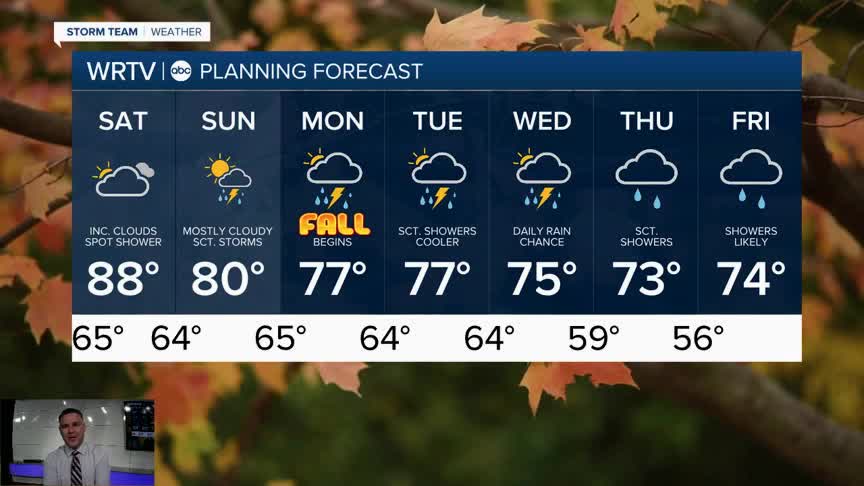
Saturday, for the most part, will be dry. You’ll notice more clouds, and yes, there could be a few isolated showers, but most of us won’t see them until Sunday. Highs will be in the mid to upper 80s. It will be the last warm day before we return to more seasonable temperatures next week.

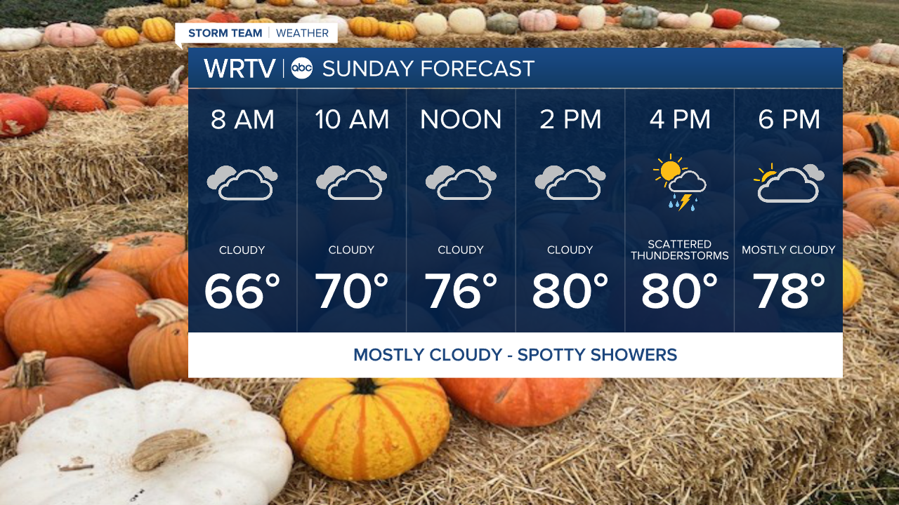
Sunday will be mostly cloudy, with a slightly better chance of scattered showers and possibly a few thunderstorms affecting the area. High temperatures will be right around 80°. Any rain will be spotty, so don’t cancel outdoor plans—just be aware that some showers may move through the area.
The best chance of rain will be from Monday onward through the rest of next week. It won’t be continuous rain, but will come in waves or spurts. Most of the rain will be light, but when you add up all the showers over seven days, most areas will likely see over an inch of rain. Some areas to the south and west could receive closer to two inches. Whatever falls will soak into the ground quickly.

Indianapolis Weather Forecast:
Saturday: Clouds increase. Spot shower or two High: 88°
Sunday: Mostly cloudy. Sct. showers. High: 80°
Monday: Sct. Showers. Fall begins High: 77°
Tuesday: Sct. Showers. High: 77°
Indianapolis 7-Day Weather Forecast

