


Headlines
- COLD BUT BRIGHT FRIDAY FORECAST
- WINTER STORM WATCH START FRIDAY NIGHT
- ACCUMULATING SNOW SATURDAY
Friday will be a cold but quiet weather day for us. Skies will feature plenty of sunshine, but temperatures will struggle to reach the freezing mark in many locations. Bundle up if you are going out shopping, but other than that, there should be no major issues for us.
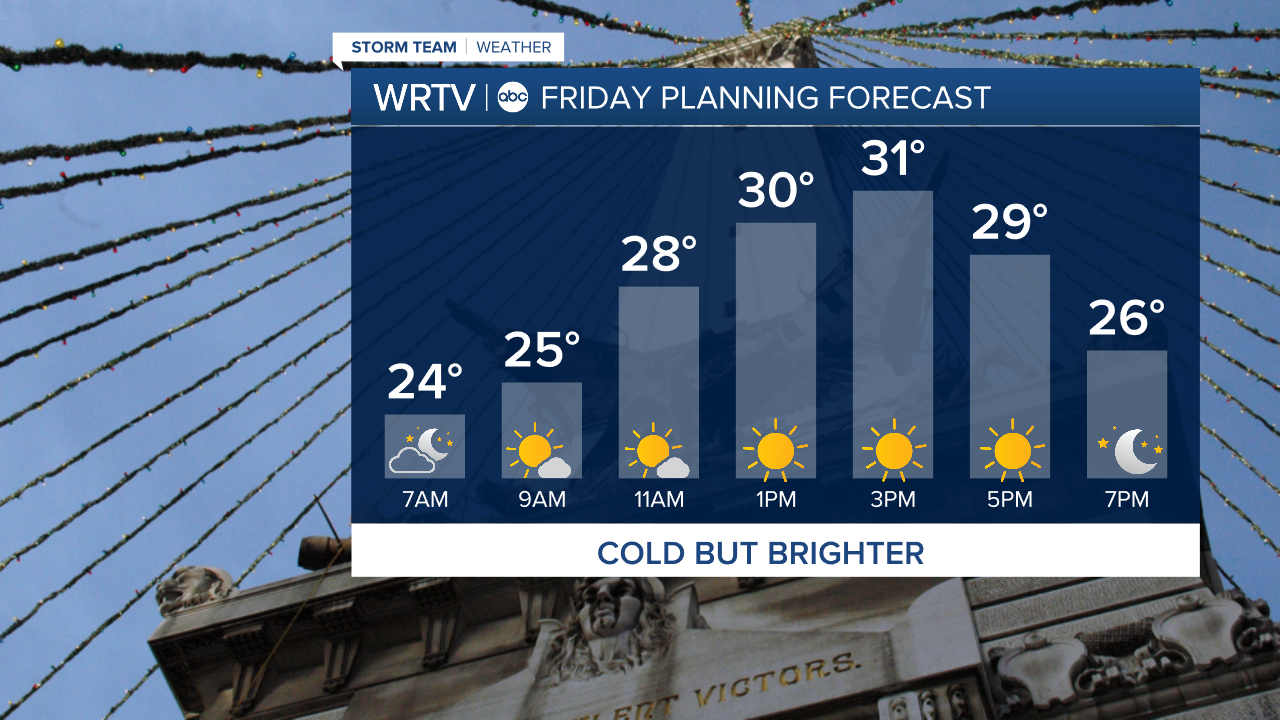
If you are heading to West Lafayette for the Old Oaken Bucket game, you will need to dress very warmly. Temperatures will be in the 20s, with wind chills even colder. A few snowflakes are possible late in the game, but most of the snow should hold off until after midnight.

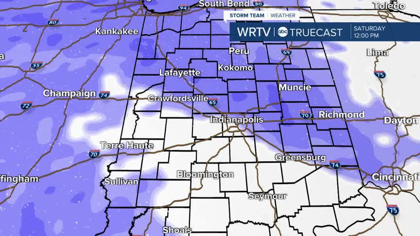
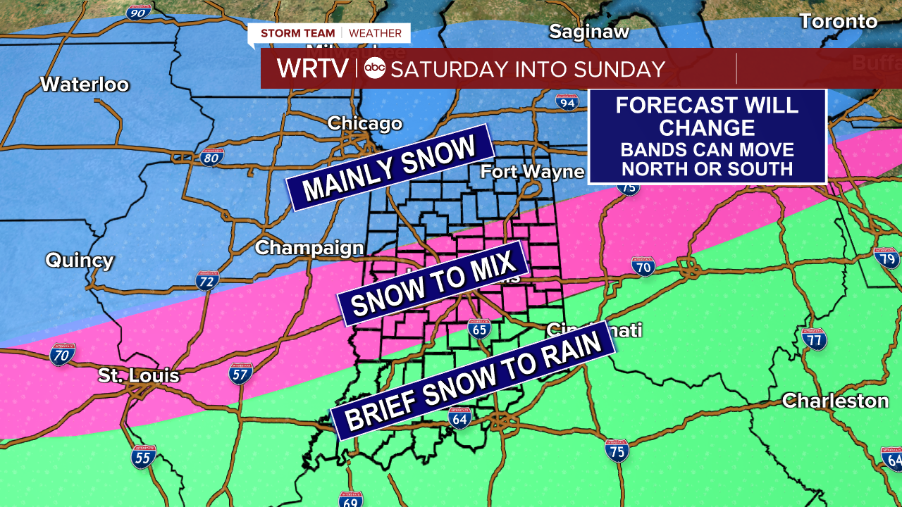
The Winter Storm Watch goes into effect Friday night. This will likely be broken down into Winter Weather Advisories and Warnings tomorrow. Snow will develop Saturday morning and become heaviest in the afternoon and evening. To the north, it stays all snow. The biggest uncertainty will be along I-70, where some rain will likely mix in Saturday evening. Southern locations will see a slushy inch or two of snow before changing over to all rain.
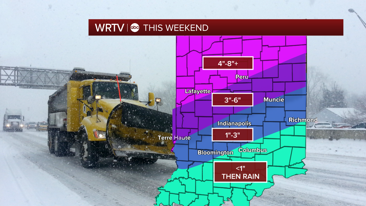
Snowfall totals will likely change somewhat through Friday, but right now it looks like 1"–3" along I-70, with higher amounts to the north and lower amounts to the south. Northwest and northern Indiana are expected to see the highest totals, potentially over 8" of snow.
Indianapolis Weather Forecast:
Overnight: Mainly clear & cold Low: 21°
Friday: Mostly sunny. High: 33°
Saturday: Snow. Mixing late. High: 34°
Sunday: Lingering Wintry Mix. High: 33°
Indianapolis 7-Day Weather Forecast

