


Headlines
- NON-SEVERE STORMS OVERNIGHT
- RECORD HIGHS TEMPS THURSDAY
- SEVERE STORMS THURSDAY NIGHT INTO FRIDAY
If you have plans this evening, you will be just fine. Get outside and enjoy the mild temperatures with no threat of rain. Overnight, the first round of storms will arrive. These storms are not expected to be severe, but heavy rain is likely, with the possibility of some small hail. The storms will move out by the morning commute, and the rest of the day will be dry with record-high temperatures.
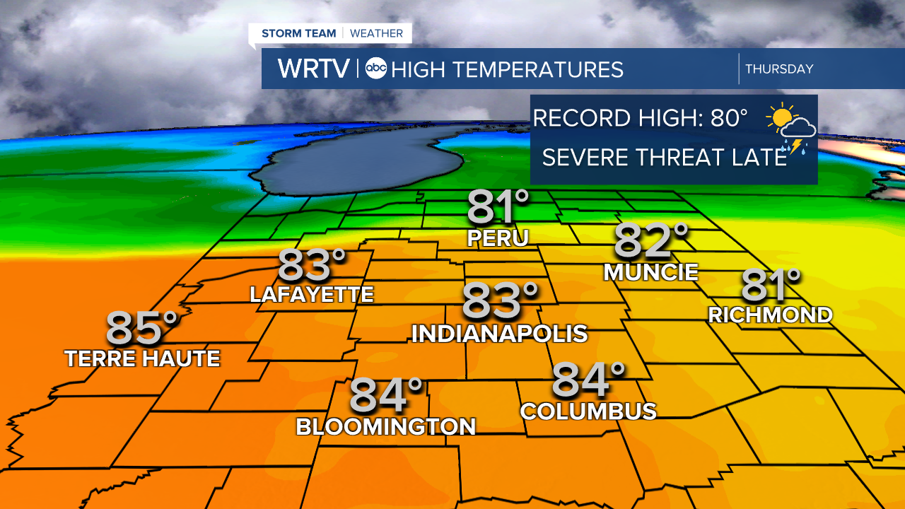
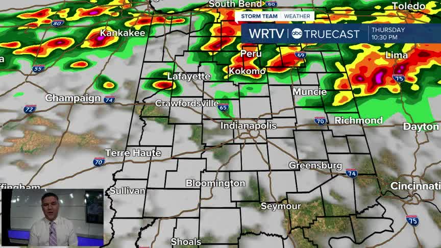
The record high temperature for Indianapolis is 80°. We should be able to surpass that as we climb into the low to mid 80s. For the most part, the daylight hours will be dry. The exception is well to the north, where some storms may sneak in before sunset, as you can see on the Truecast below. From Indianapolis northward, there is an Enhanced Risk of severe weather. The rest of the area is under a Slight Risk.
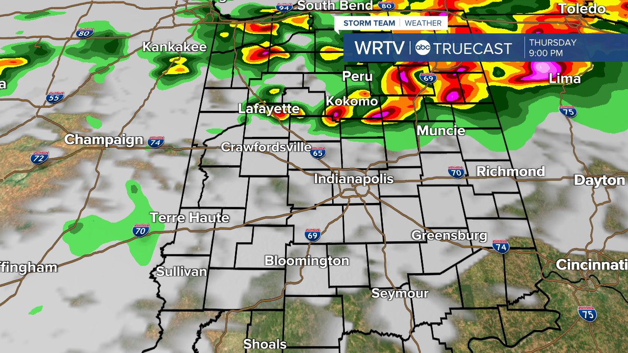
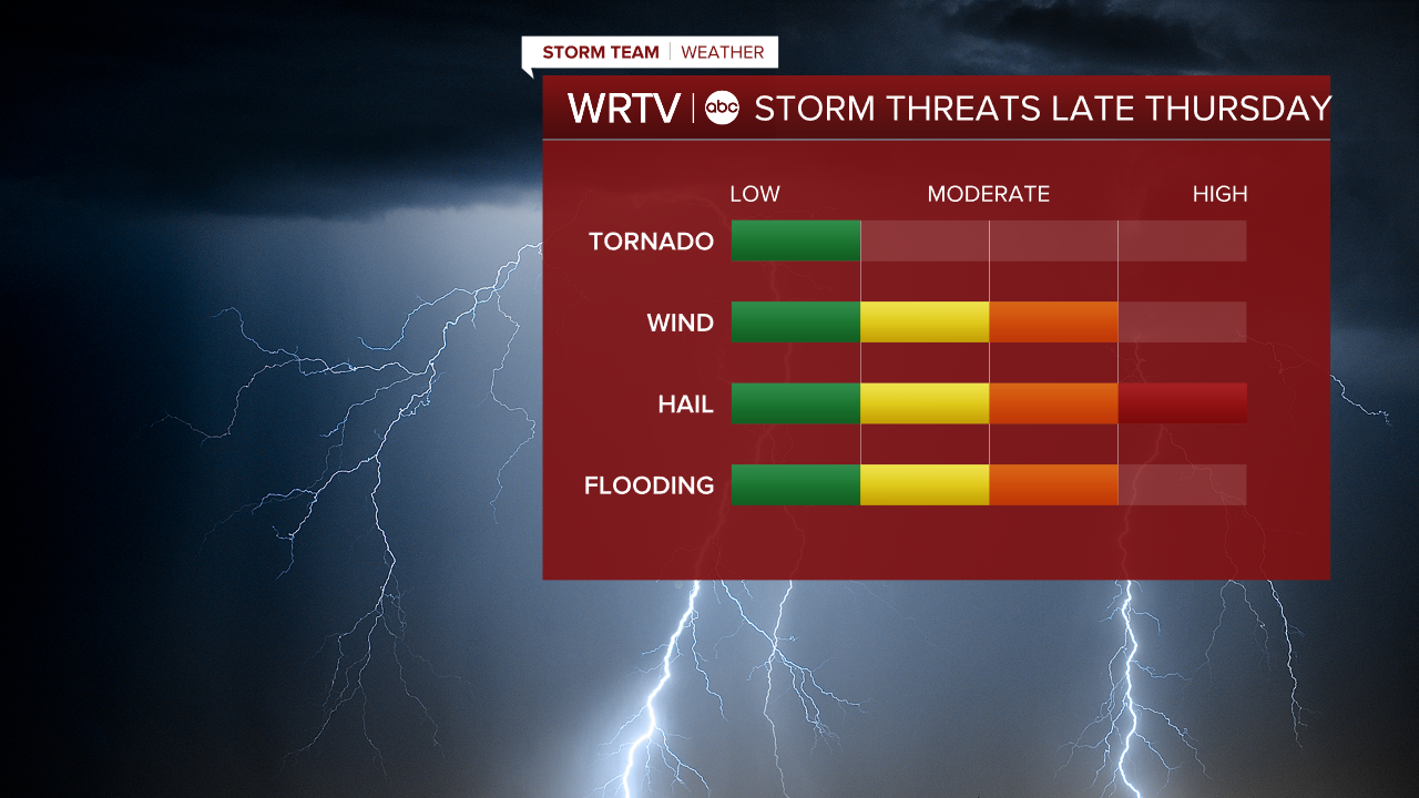
The initial storms to the north could produce very large hail and also have the best chance of a tornado. Eventually, more of a line of storms will form and sink south. At that point, we’ll transition into more of a hail and damaging wind threat. We will also have to keep an eye on the potential for flooding, as some areas could see multiple rounds of very heavy rain moving through.
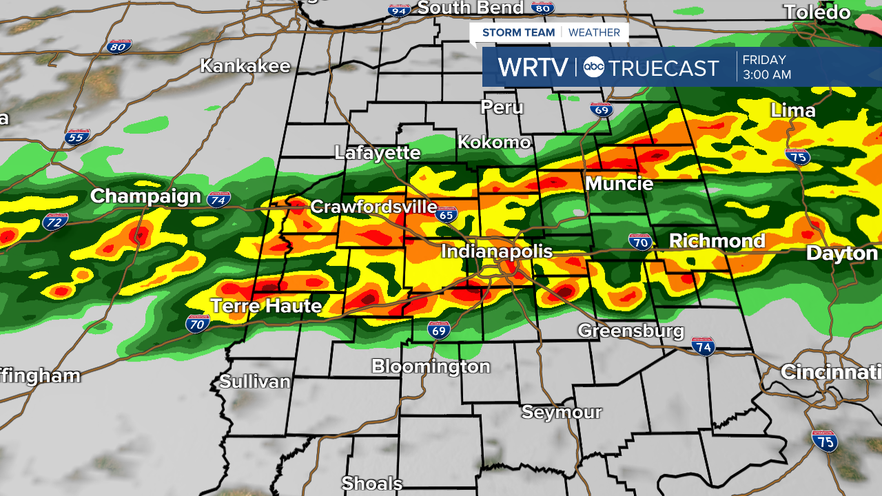
The storms will eventually move out by the morning commute and continue to weaken as they move south. To recap: hail is the main threat, followed by wind and then flooding. There will be an initial tornado threat in northern locations during the evening hours.
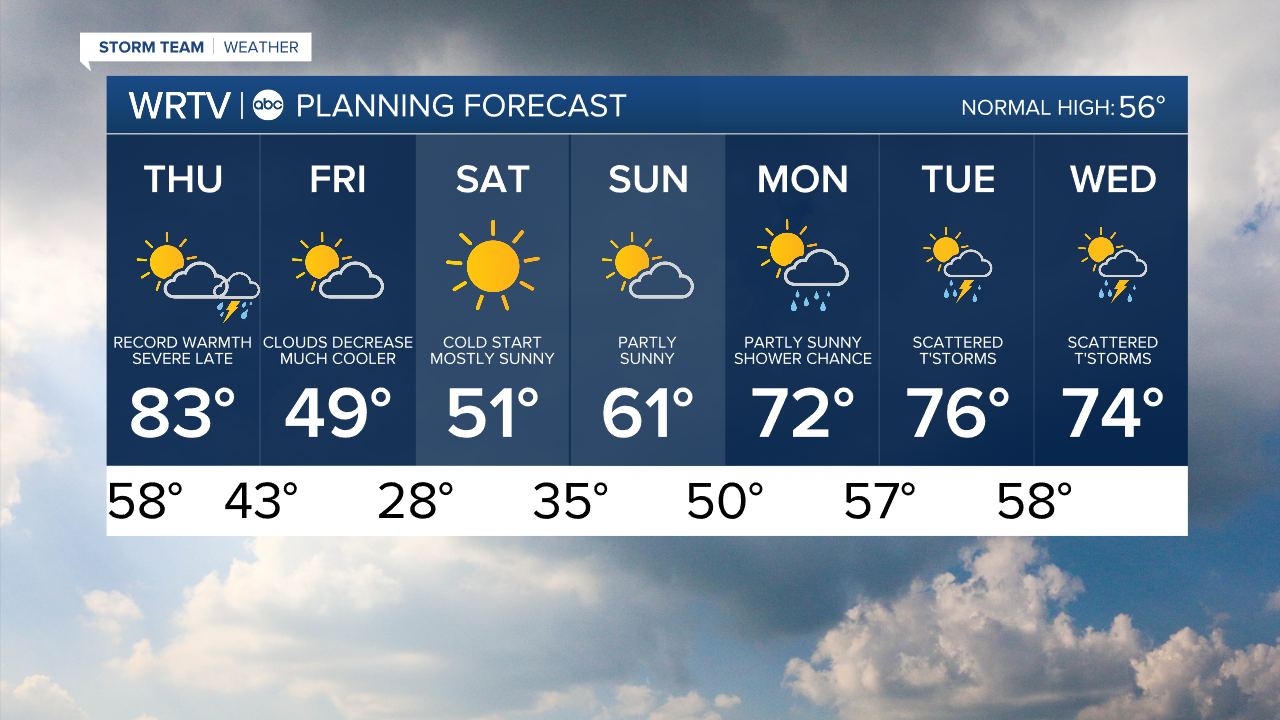
Much cooler air will then return for Friday and the weekend.
Indianapolis Weather Forecast:
Overnight: Sct. storms Low: 58°
Thursday: Record warmth. Severe threat late High: 83°
Friday: Much colder. Partly cloudy. High: 49°
Saturday: Sunny. High: 51°
Indianapolis 7-Day Weather Forecast