Headlines
- AREAS OF FOG OVERNIGHT
- RECORD HIGH TEMPERATURES LIKELY WEDNESDAY
- SEVERE THREAT THURSDAY
While it shouldn't be as widespread as Monday morning, area of go will be possible for Tuesday mornings commute.

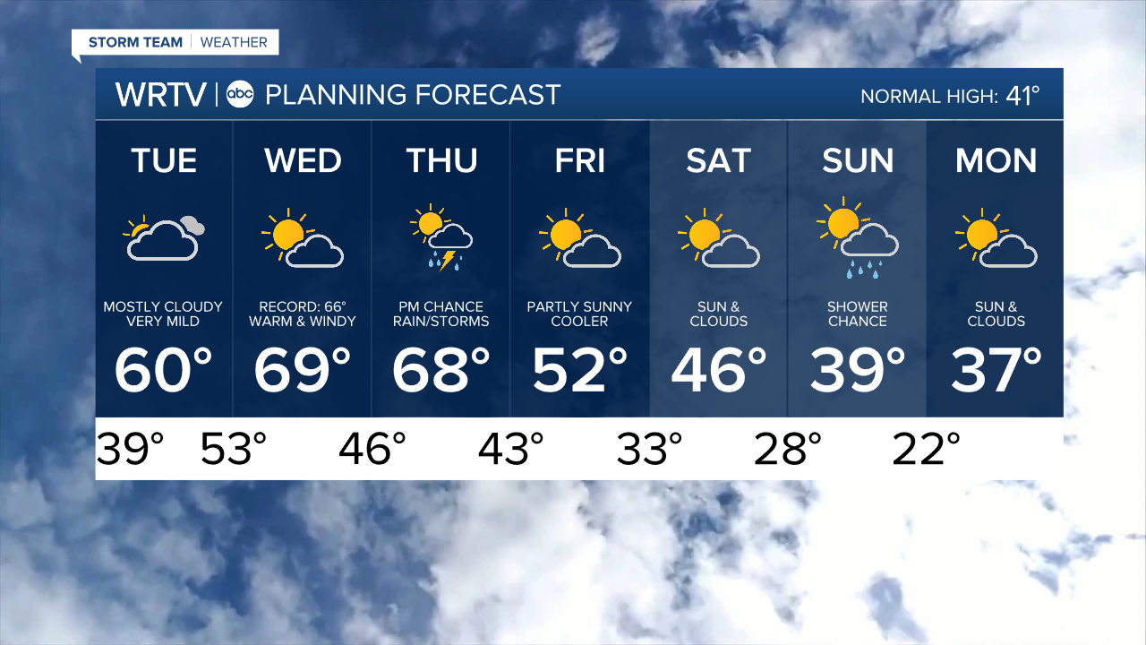
The further east you are the more dense the fog will likely to be. Several eastern counties are under a Dense Fog Advisory until 10 am. Any fog will burn off quickly and we'll be left with mostly cloudy skies throughout the day with high temperatures around 60°.

Wednesday will be the warmest day and potentially record-breaking. The record for Indy is 66°, set back in 2017. As you can see below, my forecast calls for us to top that number. Highs in the 70s are possible, depending on how quickly we can clear out the morning clouds. A few showers are possible early in the day, but most of the daytime hours will be dry.

Thursday could potentially be an ALERT DAY for us. A cold front will bring the chance of strong to severe storms to the area in the afternoon and evening. As of now, the Storm Prediction Center has highlighted the southern half of the state as a risk area.
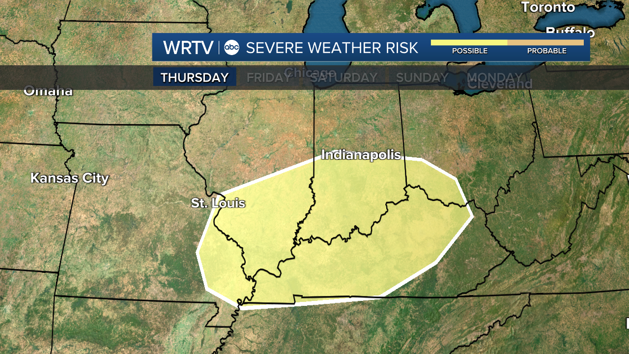
Right now, all forms of severe weather are possible. Stay with us throughout the week as things unfold. Cooler, more seasonable temperatures will return by the end of the week.
Indianapolis Weather Forecast:
Overnight: Mostly cloudy. Low: 39°
Tuesday: Mostly cloudy but warm High: 60°
Wednesday: Warm and windy. High: 69°
Thursday: Partly cloudy. PM Severe threat. High: 67°
Friday: Mostly sunny. High: 52°
Indianapolis 7-Day Weather Forecast