


Headlines
- RECORD HIGH ON WEDNESDAY
- SEVERE THREAT THURSDAY AFTERNOON & EVENING
- WINTER-LIKE RETURN THIS WEEKEND
We set a new record high temperature Wednesday at 71° in Indianapolis and it was also the first we hit 70° this year. I hope you were able to enjoy it, as much colder weather will return this weekend following the passage of a cold front. This front will bring us a chance of strong to severe storms Thursday afternoon and evening. Thursday will be a WRTV ALERT DAY.

A few showers and storms will be possible in the morning, but the threat of severe weather will be in the afternoon and evening hours. This will likely impact the evening commute, so keep that in mind as you leave work or if the kids have outdoor plans. All of central Indiana is under a slight risk for severe storms according to the Storm Prediction Center.

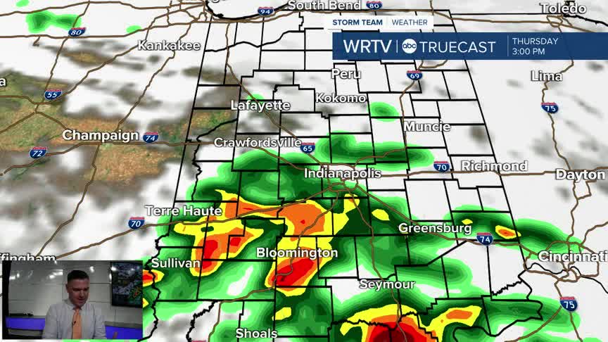
Here is what radar could potentially look like for that evening commute.
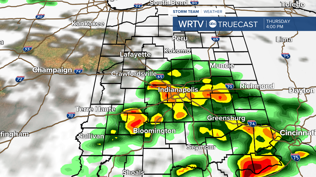
The main threat will still be strong winds for everyone. However, as the warm front moves through, there may be enough rotation for a few tornadoes to develop. The best chance for this will be south of I-70, but even north of the highway there will still be a chance, at least early in the afternoon. Once we get into the evening hours and the cold front comes through, it will become more of a wind event.

Following the cold front, we will return to much colder weather for the weekend, as you can see in the 7-day planning forecast below.
Indianapolis Weather Forecast:
Overnight: Mostly cloudy Low: 47°
Thursday: PM Severe threat. Showers & storms. High: 66°
Friday: Partly cloudy. Much colder. High: 47°
Saturday: Mostly sunny. High: 41°
Indianapolis 7-Day Weather Forecast

