


Headlines
- SHOWERS & STORMS THROUGH WEDNESDAY
- SOME AREAS COULD SEE OVER AN INCH OF RAIN
- BEAUTIFUL WEEKEND AHEAD
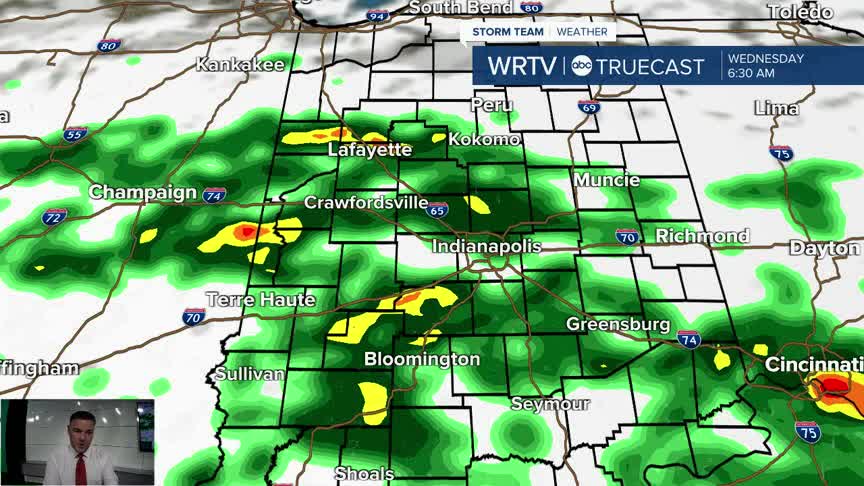
Wednesday will be the wettest day remaining this week, with periods of rain off and on. The first half of the day looks to have the most widespread rain, with showers and storms being fairly numerous. Expect a wet morning commute in many areas. As the day progresses, the rain will become more scattered in nature, but I would still keep rain gear handy if you’re going to be out and about. Temperatures will be on the cool side, in the low 70s.

Rain chances will continue on Thursday, especially in the morning. Once we get to the afternoon, the rain chances will decrease, and that trend will continue into Friday as well. Most areas will see between 0.50 and 1 inch of rain, with isolated locations receiving more. The heaviest totals look to be south of I-70.

Once we get to Friday, it looks like we have a beautiful stretch of weather for the upcoming weekend. The first weekend of fall will feature sunshine and highs around 80°.

Indianapolis Weather Forecast:
Overnight: Sct. storms Low: 66°
Wednesday: Areas of showers and storms High: 73°
Thursday: Morning showers then some clearing. High: 75
Friday: Mostly sunny. Stray shower. High: 77°
Saturday: Sunny. High: 80°
Indianapolis 7-Day Weather Forecast

