


Headlines
- SNOW SHOWERS NEW YEAR'S EVE
- COLD, SUNNY START TO 2026
- WARMING THIS WEEKEND
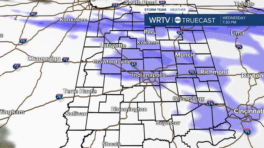
Tuesday night's flurries should come to an end before Wednesday morning, but we are preparing for another round of snow showers Wednesday evening.
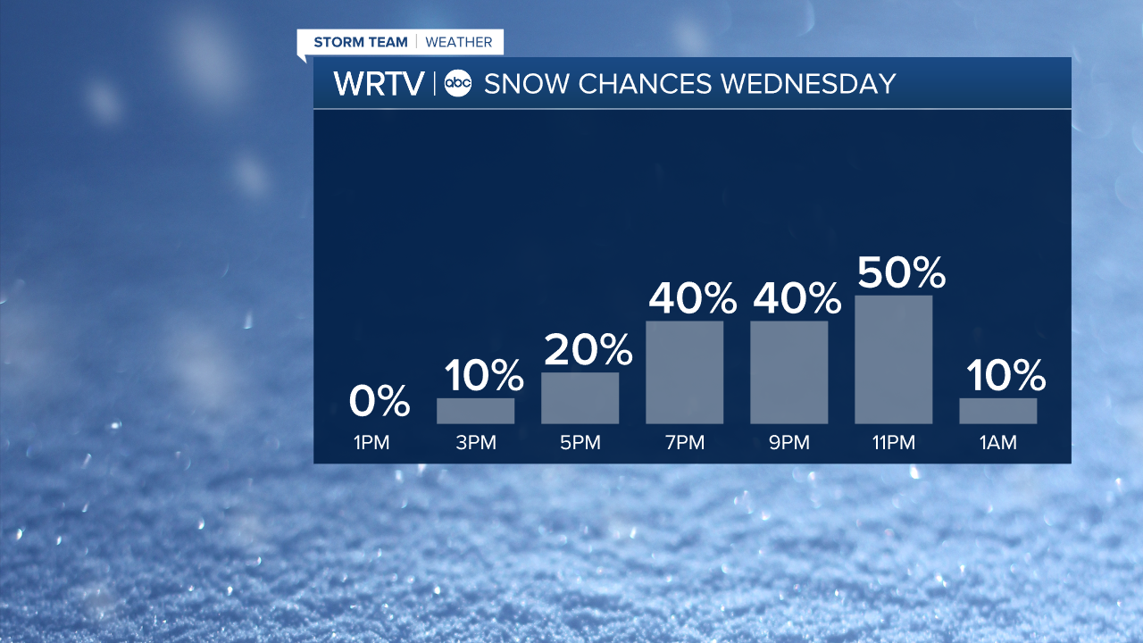
The final day of 2025 will be slightly warmer than Monday and Tuesday, with highs climbing into the mid 30s. The day is mostly cloudy, with light snow showers starting in the afternoon and continuing into the evening. Be prepared that falling snow could slow you down if you'll be driving New Year's Eve evening.
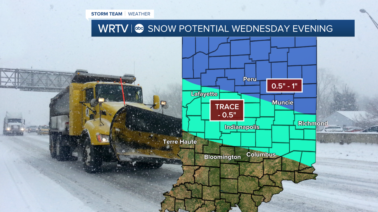
Accumulations should stay low on Wednesday, with the highest totals north of Indianapolis, up to about an inch of snow. Many areas will only see trace amounts of snow, possibly up to about half an inch.
Thursday is the start of 2026. The day is dry and sunny, but cooler air returns, with highs in the 20s.
Temperatures will rebound a bit heading into Friday and the weekend, with highs ending in the low 40s at the end of the 7-Day Forecast.
Indianapolis Weather Forecast:
Wednesday: Mostly cloudy with PM snow showers. High: 35°
Thursday: Mostly sunny and cold. High: 29°
Friday: Mostly cloudy. High: 36°
Indianapolis 7-Day Weather Forecast

