


Headlines
- BITTER COLD TEMPS ARE HERE TO STAY
- BELOW ZERO EVERY MORNING THIS WEEK
As expected, snowfall totals have been impressive across the area, with most locations south of I-70 receiving over 10 inches. Amounts have been lower, but still substantial to the north. The Winter Storm Warning will remain in effect overnight due to difficult travel conditions.

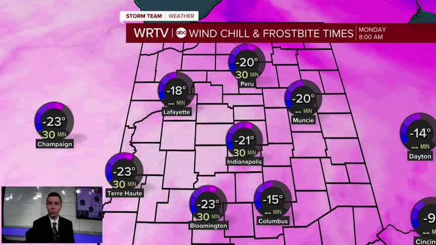
While the snow has ended, our problems will remain due to bitterly cold temperatures expected for the rest of the week. In fact, low temperatures will likely be below zero each day, with Wednesday potentially being the coldest at -10°F.

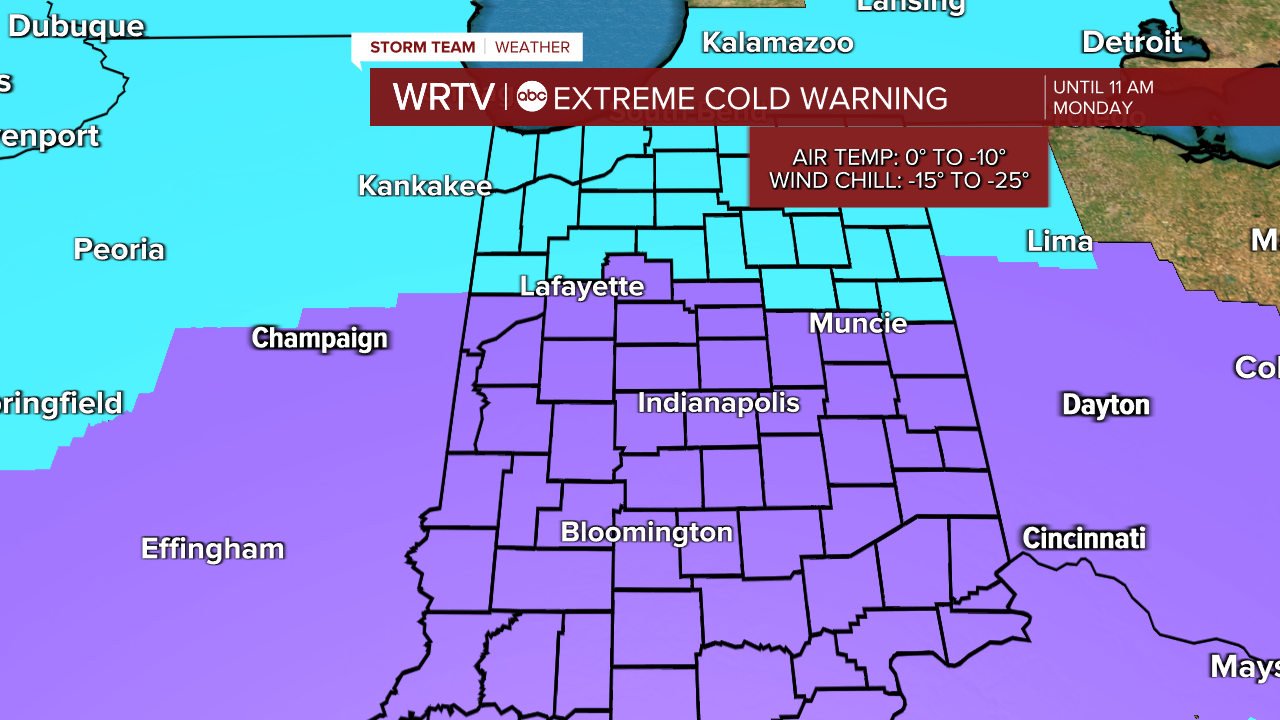
An Extreme Cold Warning is in effect for the entire area overnight tonight. That will change to a Cold Weather Advisory during the day tomorrow, from 11 a.m. to 7 p.m., before returning to an Extreme Cold Warning tomorrow night. This pattern is likely to continue for the rest of the week.
Highs temperatures on Monday will only be in the single digits during the afternoon hours.

Indianapolis Weather Forecast:
Monday: Bitter temps. Partly cloudy. High: 7°
Tuesday: Partly cloudy. Low: -4°, High: 20°
Wednesday: Partly cloudy. Low: -10° High: 15°
Indianapolis 7-Day Weather Forecast

