


Headlines
- COLD AND BREEZY FRIDAY
- SOME SLICK SPOTS
- TEMPERATURES REBOUND SATURDAY
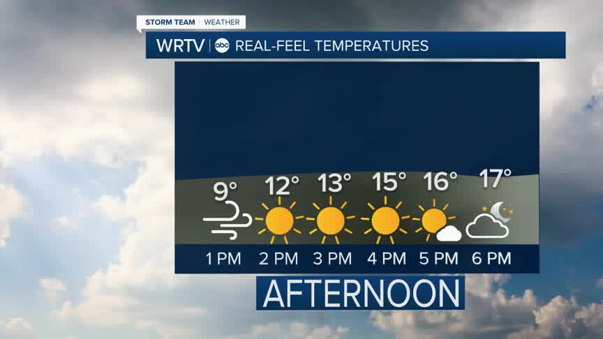
Winter weather is back in the forecast Friday. Temperatures are in the 20s, but wind chills will struggle to warm into the teens this afternoon. Be cautious that there could be some slick spots, especially on untreated roads and sidewalks.

After starting the morning with wind gusts 45+ mph, the afternoon will see wind gusts slowly calming.

The lingering snow flurries will come to an end, and clouds will slowly break this afternoon.
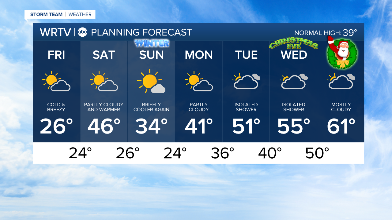
The bitter cold is short lived. Temperatures climb a bit into the low 30s by Saturday morning. Saturday afternoon is mostly cloudy but dry with highs in the mid 40s. It may be a little breezy at times still Saturday.

The winter solstice is at 10:03 a.m. Sunday. Temperatures are briefly cooler again, with highs in the mid 30s. Enjoy lots of sun on Sunday.
Temperatures will warm through the 40s and 50s next week, before peaking near 60° on Christmas Day Thursday.
An isolated rain shower cannot be ruled out on Tuesday or Wednesday.
Indianapolis Weather Forecast:
Today: Cold and breezy. Wind chills in the teens. High: 26°
Overnight: Few clouds. Low: 24°
Saturday: Partly cloudy and warmer. High: 46°
Sunday: Mostly sunny and cooler. High: 34°
Indianapolis 7-Day Weather Forecast