


Headlines
- BREEZY FRIDAY
- RAIN RETURNS LATE SATURDAY
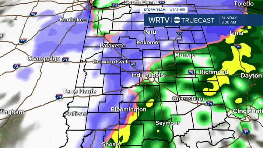
- RAIN/SNOW SUNDAY
- WINTER TEMPERATURES ARRIVING
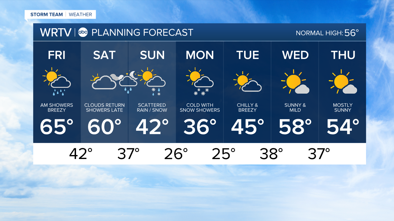
Enjoy the mild weather while it lasts Friday and Saturday - we will get a taste of winter Sunday into early next week.
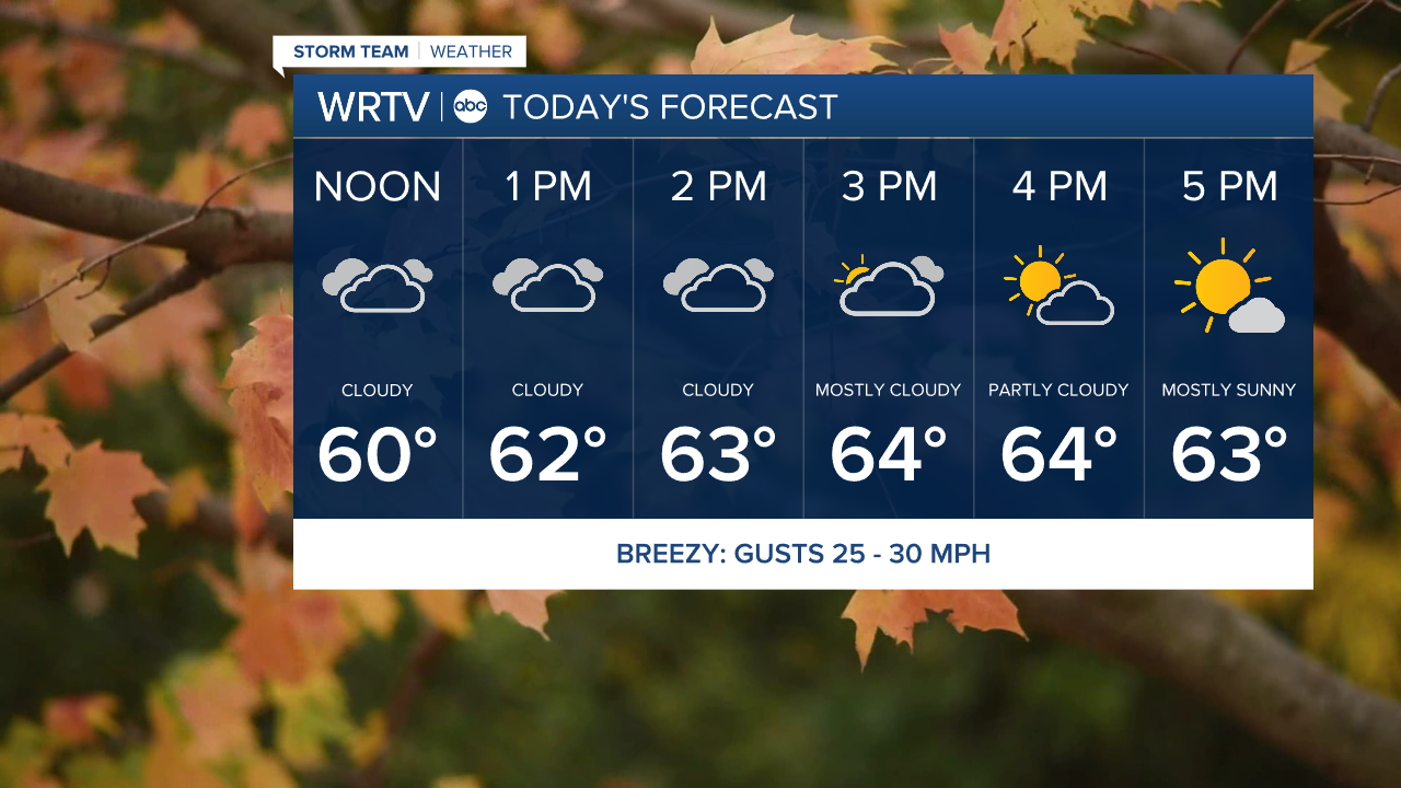
Friday afternoon and evening, clouds slowly start to clear. It's breezy with some 30 mph wind gusts. Highs are in the mid 60s.
Temperatures fall through the 50s this evening. It will be a great opening night for Christmas Nights of Lights at the Indiana State Fairgrounds.

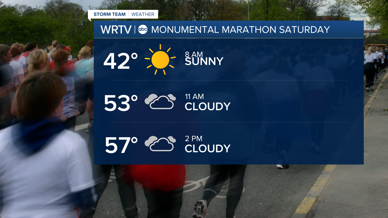
Saturday morning will start in the upper 30s to low 40s. For anyone running the Monumental Marathon in Indianapolis on Saturday, dressing in layers will be key - as we climb near 60° by afternoon. The day itself should stay dry, although you'll see more clouds as the day progresses.
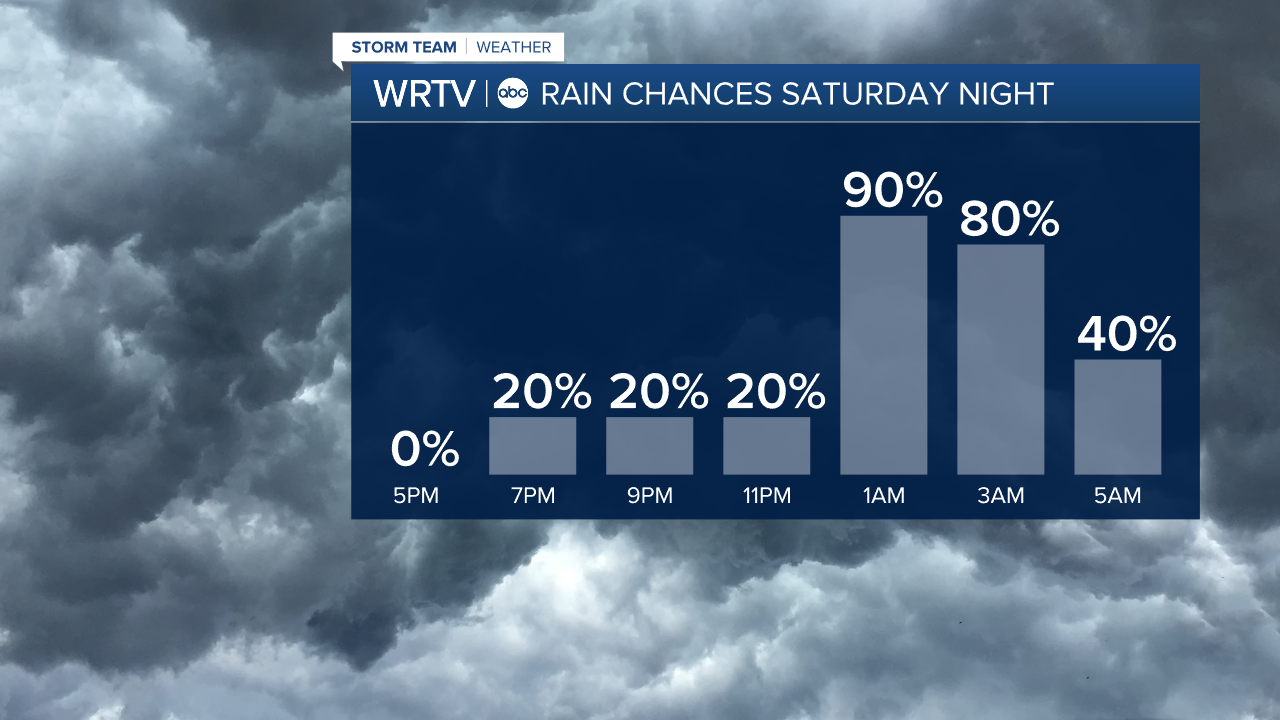
It's not until Saturday evening that rain showers move into the area. Precipitation continues into Sunday, but as temperatures start to drop, we could see a rain/snow mix Sunday, gradually turning to all snow showers, which linger into Monday.
Monday morning will start in the mid 20s, so make sure to find your hat and gloves. Monday stays cooler than normal, with highs staying in the mid 30s.
There's another cold start Tuesday in the mid 20s, then temperatures start to rebound for the rest of next week.
Indianapolis Weather Forecast:
Today: AM showers. Breezy. PM clouds clearing. High: 65°
Overnight: Mostly clear skies. Low: 42°
Saturday: Increasing cloud cover. Showers starting late. High: 60°
Sunday: Cooler with scattered rain/snow showers. High: 42°
Indianapolis 7-Day Weather Forecast