


Headlines
- ANOTHER ROUND OF LIGHT SNOW WEDNESDAY MORNING
- WARMING TREND INTO THE WEEKEND
- SPRING-LIKE RIGHT ON CUE FRIDAY
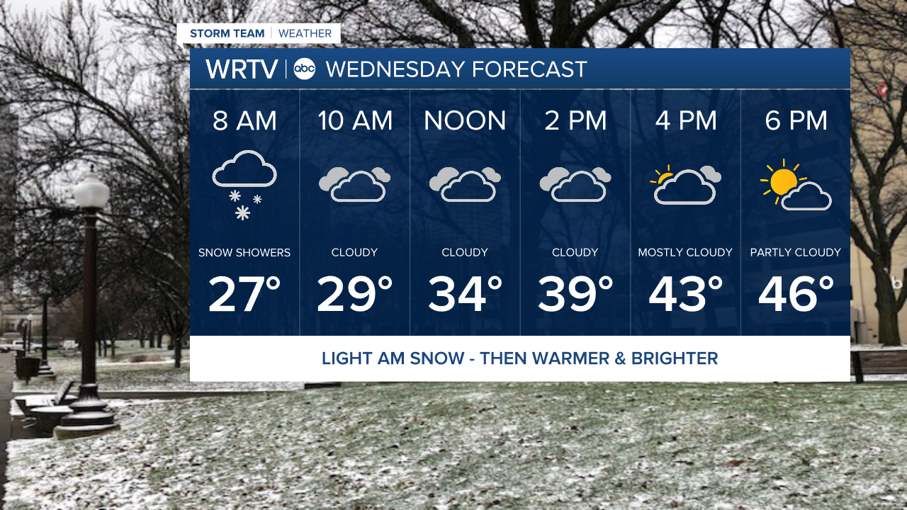
Winter is not letting go easily this week, even as we prepare to officially welcome spring on Friday. Our St. Patrick’s Day was the second coldest on record for a high temperature, and we have another round of light snow expected overnight into the Wednesday morning commute. Some slick spots will be possible.

Any accumulation will be light—generally just a coating to maybe half an inch in most areas. If we overachieve, there could be up to an inch in isolated spots. However, whatever does fall will stick due to the cold temperatures that have been in place.
Any snow that does fall will melt quickly, as temperatures are expected to climb into the mid-40s by the afternoon, with sunshine returning as well.
On Thursday, another quick clipper will move through, but this one will bring only rain. Behind that, we’ll really start to warm up. Spring officially arrives on Friday, and it will start to feel more like it as temperatures jump into the upper 60s.
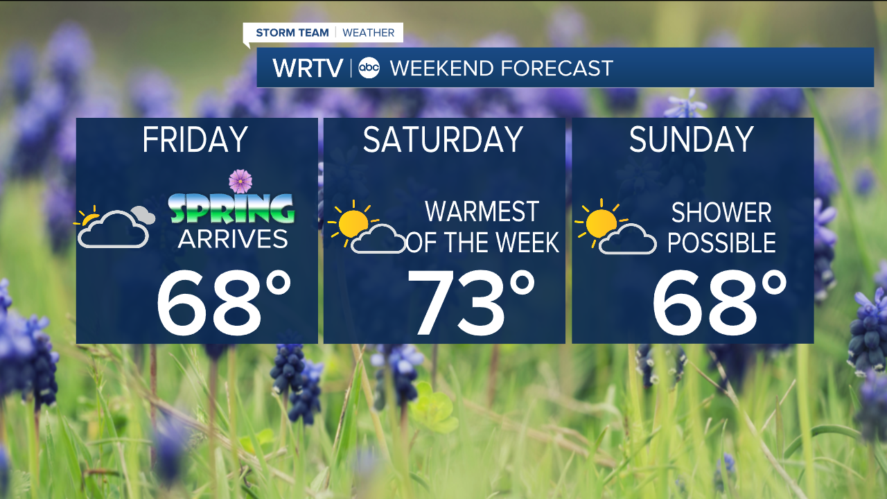
Saturday is the warmest day of the weekend and the weekend. Sunday is still mild but a few showers will be possible.
Indianapolis Weather Forecast:
Overnight: Light snow Low: 25°
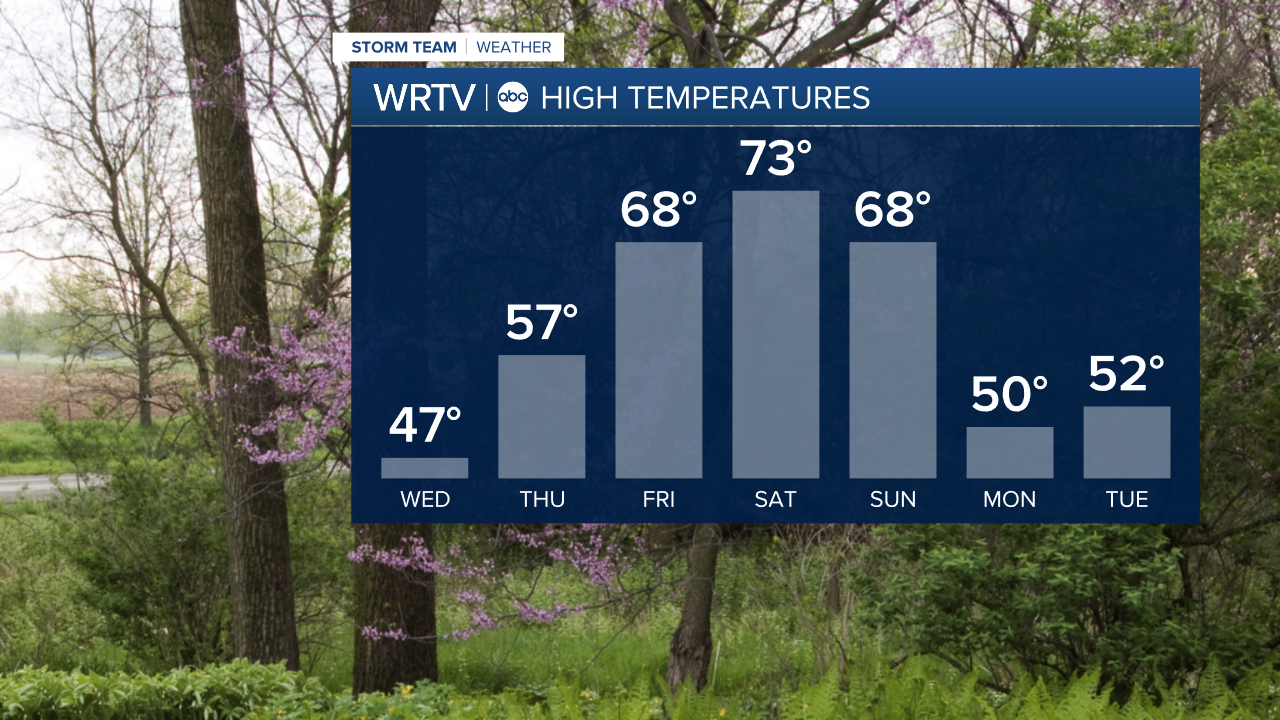
Wednesday: Morning snow then sunny & warmer High: 47°
Thursday: Morning rain then partly cloudy. High: 57°
Friday: Mostly cloudy. High: 68°
Saturday: Partly cloudy. High: 73°
Indianapolis 7-Day Weather Forecast

