


Headlines
- PATCHY DENSE FOG OVERNIGHT
- TEMPERATURES INCH BACK TO 90°
- HUMIDITY CLIMBS AS WELL
Overnight, some areas could experience patchy fog, so be aware of that.
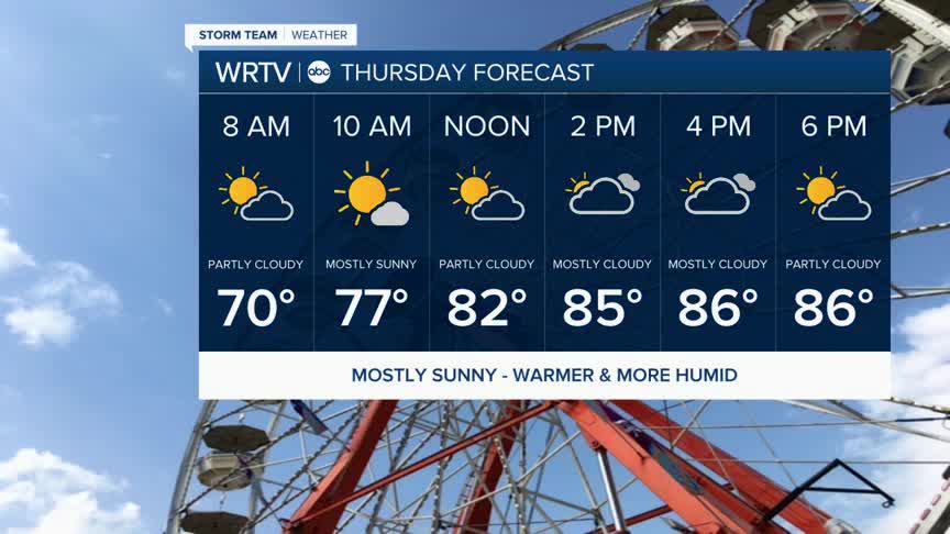
Rain chances are excluded from the forecast starting tomorrow and lasting through most of the weekend. A few showers may sneak in late Sunday, but otherwise, the focus will be on the rising heat and humidity. Highs on Thursday are expected to be around 90°.

Starting Friday and continuing through the weekend, temperatures will be in the low 90s, with heat index values in the mid 90s. We likely won't reach heat advisory criteria, but it will still be fairly uncomfortable during the peak heat of the day

Indianapolis Weather Forecast:
Overnight: Partly cloudy. Patch Fog Low: 68°
Thursday: Mostly sunny. Warmer. High: 90°
Friday: Mostly sunny. High: 90°
Saturday: Mostly sunny. High: 91°
Sunday: Mostly sunny. High: 91°
Indianapolis 7-Day Weather Forecast

