


Headlines
- DRY & MILD THROUGH FRIDAY
- STRONG COLD FRONT SATURDAY PM
- WINDY AND WET INTO SUNDAY
Big changes are finally heading our way as we approach the weekend. After a warm and dry September and October, we will start to trend more seasonable for the rest of the month, with more active weather as well. Saturday afternoon will bring the first in a series of strong cold fronts to our area. As you can see below, temperatures will drop from near 80° on Saturday to the low 60s on Sunday. We will then remain in the 60s for much of next week. While that’s cooler, it is actually seasonable for this time of year.

Before that storm arrives, we will have a very pleasant Thursday with plenty of sunshine and comfortable temperatures in the low 70s. Get out and enjoy it!

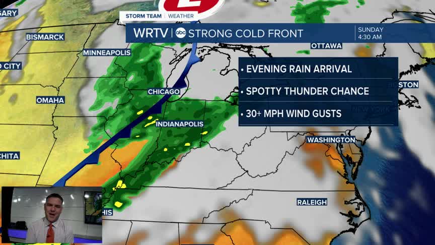
Friday will remain dry before the cold front arrives Saturday afternoon, continuing into the evening and overnight hours.

Rain will develop Saturday late afternoon or early evening, moving from west to east. The heaviest rain will likely occur later in that timeframe and continue into the overnight hours. A few storms will be possible, but the severe threat should remain to our south. One factor that will impact everyone, however, will be the wind. Expect wind speeds in the 30 to 40 mph range for much of the period while the front passes.

Scattered showers will continue into Sunday as the cooler temperatures settle in.
Indianapolis Weather Forecast:
Overnight: Partly cloudy. Low: 52°
Tomorrow: Sun & clouds High: 71°
Friday: Clouds increase. High: 72°
Saturday: Windy - Rain Develops High: 80°
Sunday: Lingering showers. Much cooler High: 62°
Indianapolis 7-Day Weather Forecast

