


Headlines
- WARMING TREND CONTINUES
- PATCHY DRIZZLE OVERNIGHT / WEDNESDAY MORNING
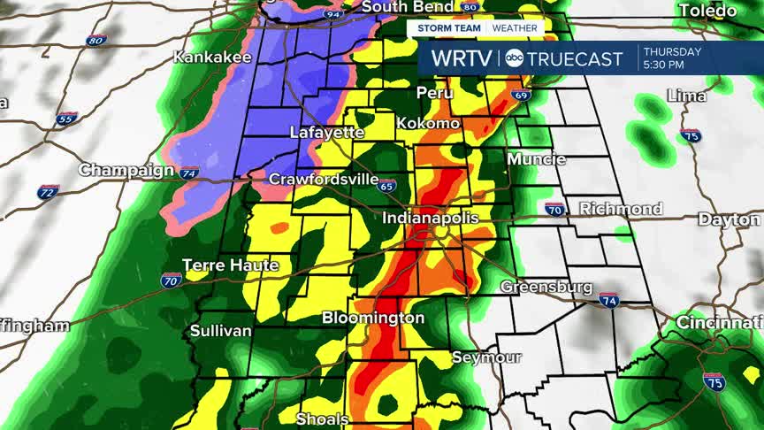
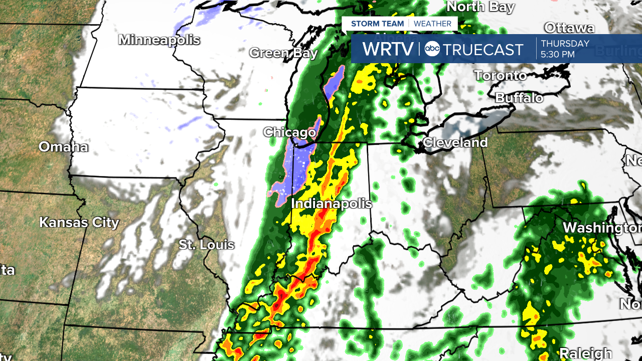
- RAINY THURSDAY
- FLASH FREEZE POSSIBLE FRIDAY MORNING
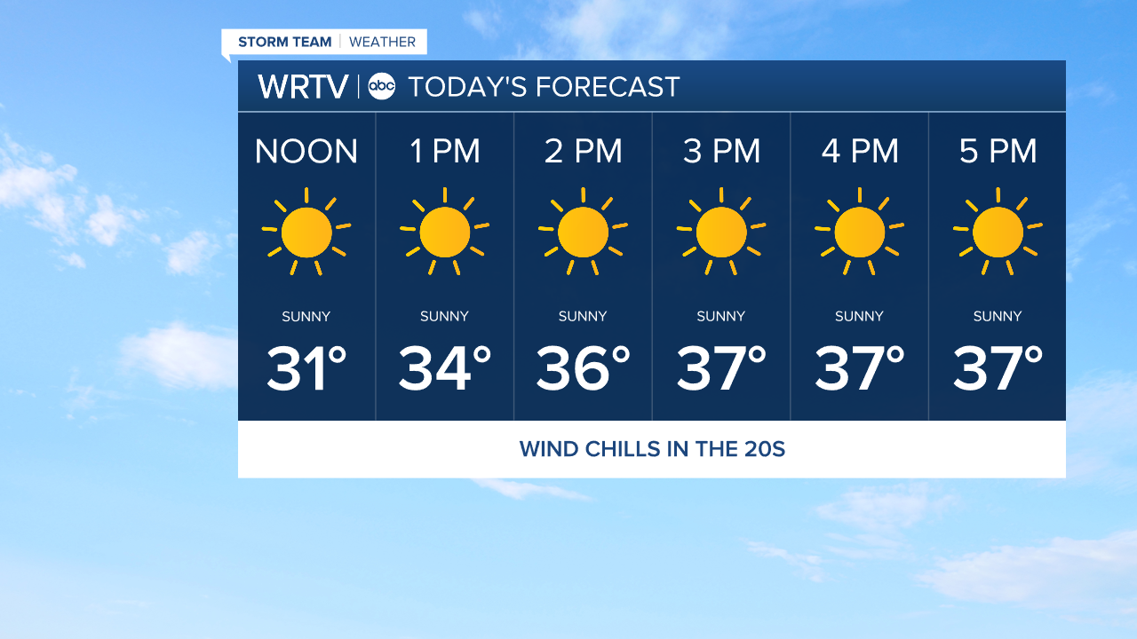
After a cold start Tuesday morning, this afternoon, we'll finally see temperatures climb above the freezing mark. Highs are in the mid 30s across Central Indiana. Skies are mostly sunny today. The breeze picks up a little this evening.
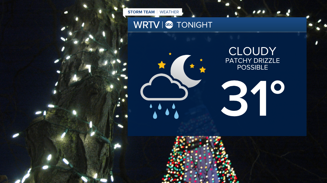
Overnight, clouds push into the area. Temperatures won't fall much, with lows in the low 30s. A little bit of patchy drizzle or fog is possible overnight and into early Wednesday. This could cause slick spots on Wednesday morning's commute.
After the patchy drizzle in the morning, the majority of the day Wednesday is dry with high temperatures climbing into the low 40s. Enjoy the dry weather and mild temperatures.
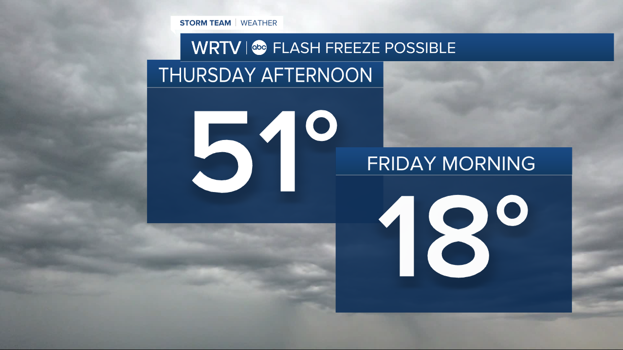
Thursday is warmer, with highs in the low 50s, but rain returns. Showers are scattered in the morning, then a steadier line of rain moves through during the afternoon and evening. This could slow the evening commute. Be sure to have an umbrella.
As the line moves out of the area, temperatures drop quickly. Temperatures Friday morning are in the teens. A flash freeze is possible - as the wet roads from the rain could become slick.
The cool-down is short lived, with highs in the 20s Friday, then rebounding into the 40s this weekend.
Indianapolis Weather Forecast:
Today: Mostly sunny. High: 36°
Overnight: Mostly cloudy. Patchy drizzle / fog possible. Low: 31°
Wednesday: AM drizzle / fog. Sun & clouds. High: 40°
Thursday: Rain likely. High: 51°
Indianapolis 7-Day Weather Forecast

