


Headlines
- ABOVE NORMAL STILL SATURDAY
- TEMPS TUMBLE SUNDAY WITH RAIN/SNOW SHOWERS
- WIND CHILL VALUES IN THE TEENS MONDAY MORNING
Temperatures on Saturday will remain above normal, but skies will be mostly cloudy. There could even be some patchy drizzle in northern locations. However, rain will move back into the area Saturday evening, so keep this in mind if you have late plans.

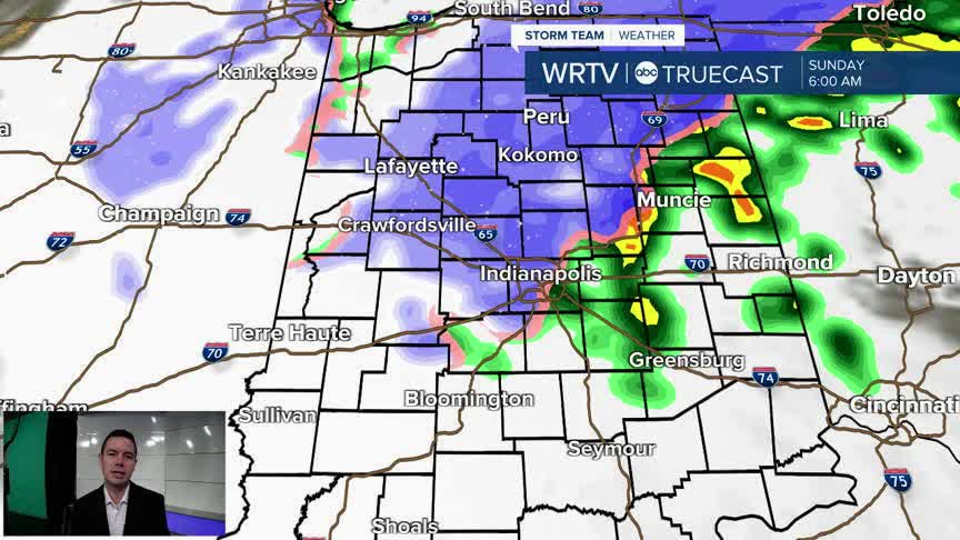
Rain could be heavy in spots late Saturday into Sunday morning. Once that storm moves east, we will see drastically colder air move in for Sunday and Monday. Expect low temperatures in the 20s, with wind chill values in the teens. Highs will only reach the 30s during the afternoon hours. And, for some of you, accumulating snow will also be possible.

The snow will mainly accumulate on grassy areas, and the further north you are, the better your chance of seeing some minor accumulations. Exceptions will be right along the lakeshore, where higher totals are possible. Most of the snow showers that move downstate will be lake-effect, so wind direction will be important. If you are traveling, especially after sunset, a few slick spots could develop in areas that receive snow. South of Indy, some flakes are possible, but no significant accumulation is expected.

This will be through Sunday and the first half of Monday. Below are the wind chill values as you wake up Monday morning.

Indianapolis Weather Forecast:
Saturday: Mostly cloudy - Rain late High: 61°
Sunday: Cold & Windy. Rain/Snow showers. High: 40°
Monday: Very cold with snow showers. High: 37°
Indianapolis 7-Day Weather Forecast

