Headlines
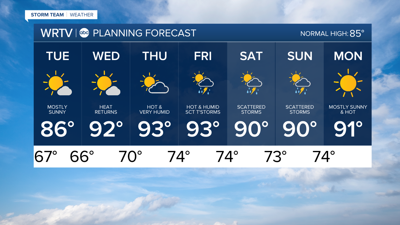
- TUESDAY IS THE BEST DAY OF THE WEEK
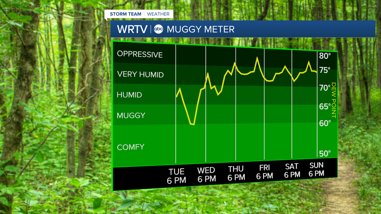
- EXTREMELY MUGGY WEATHER THE END OF THE WEEK
- HEAT INDEX VALUES OVER 100° STARTING WEDNESDAY
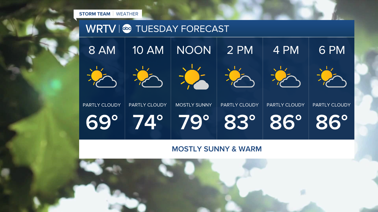
Tuesday will be a fairly seasonable day for us, with plenty of sunshine. We get a break from the rain, and while the humidity builds a bit during the day, it isn't particularly impressive until the middle to end of the week.
We don't often see dew point temperatures in the upper 70s to around 80°F in Central Indiana, but that's where we will be by the middle to end of the week. You will work up a sweat without much effort if you are outside. When you throw in high temperatures climbing back into the 90s, that results in real-feel temperatures in the triple digits.
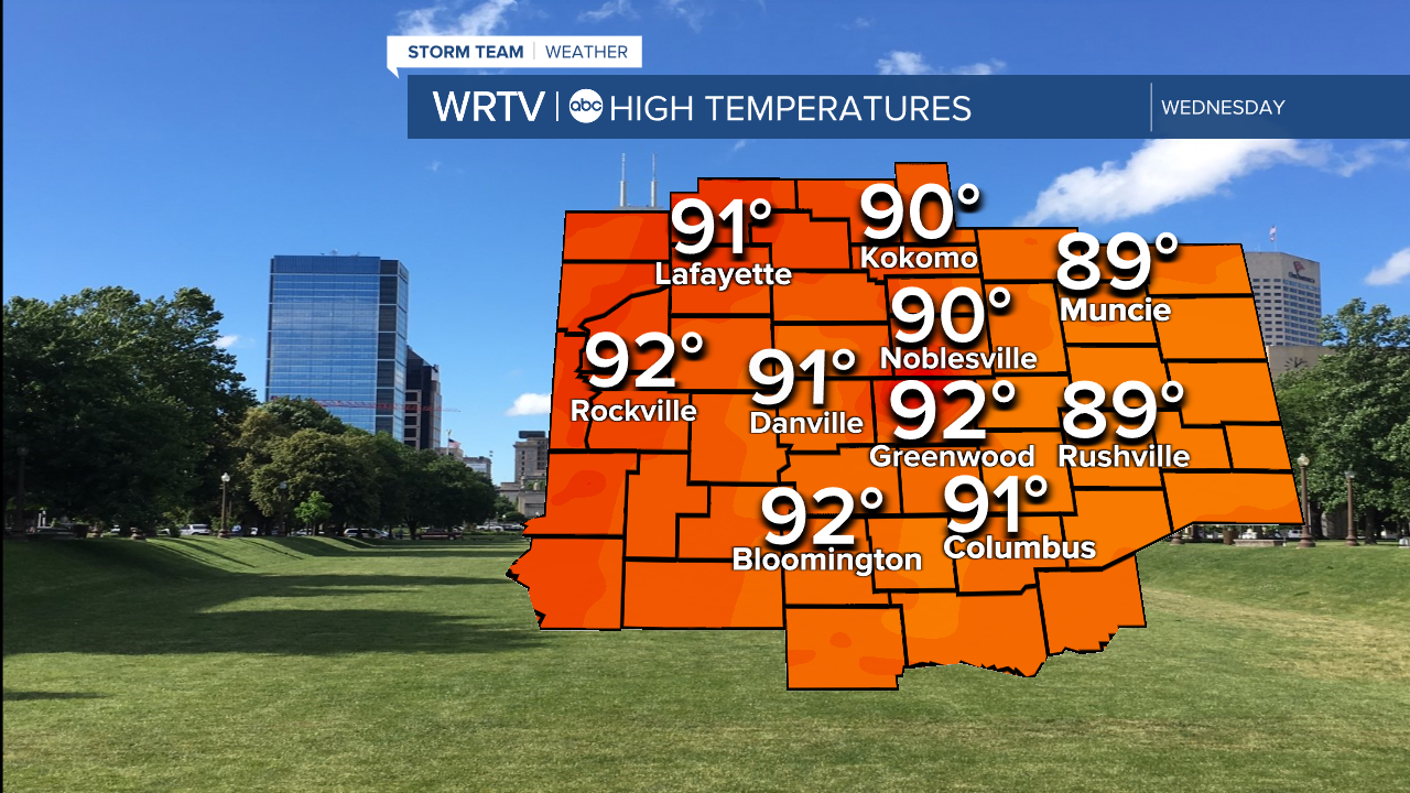
Wednesday will be first day that we are back in the 90s.
Here are you real feel temperatures going forward the rest of the week.
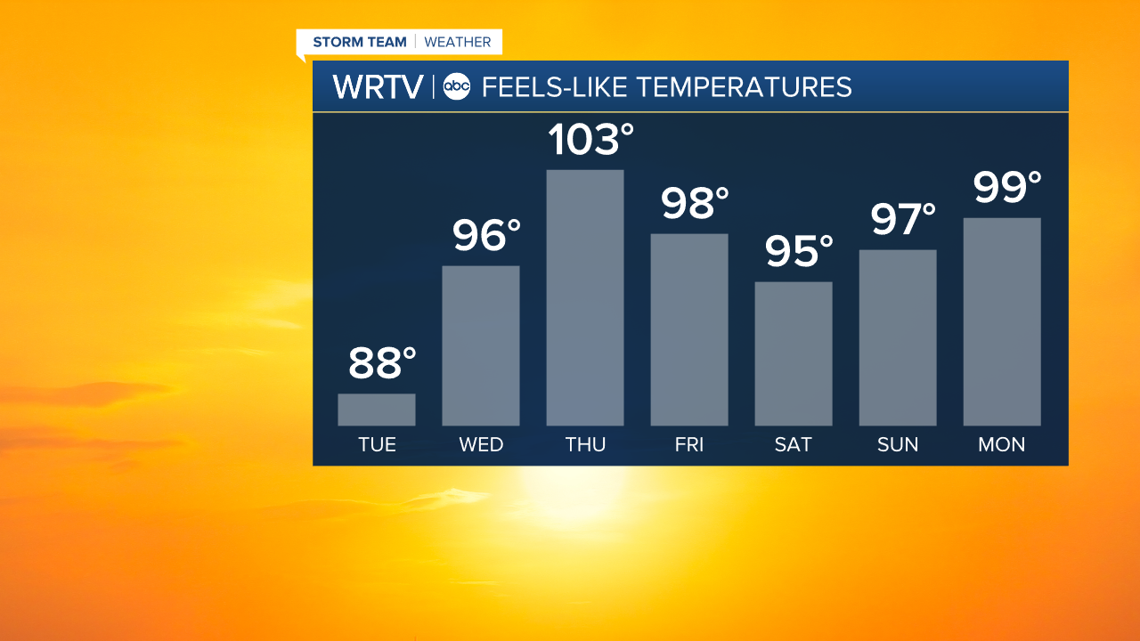
Thursday is likely to have the highest heat index, but other days will be very uncomfortable as well. Heat-related illnesses can sneak up on you, so make sure to keep yourself safe and check on your neighbors. Remember that there are many public places with air conditioning where you can go for some relief.
Indianapolis Weather Forecast:
Overnight: Mostly sunny. Low: 71°
Tuesday: Sun & clouds High: 86°
Wednesday: Hot & humid. Hazy Sun. High: 92°
Thursday: Mostly sunny. Very hot & Humid. High: 93°. Heat Index: 100°+
Indianapolis 7-Day Weather Forecast