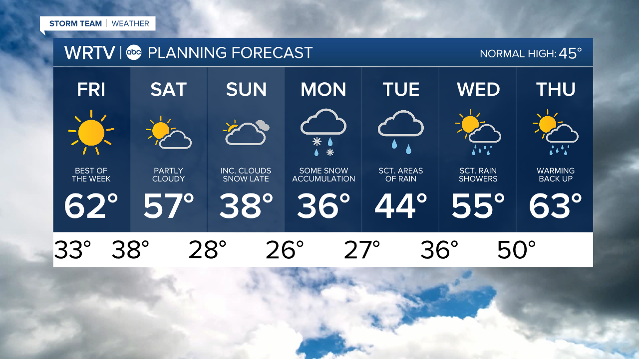


Headlines
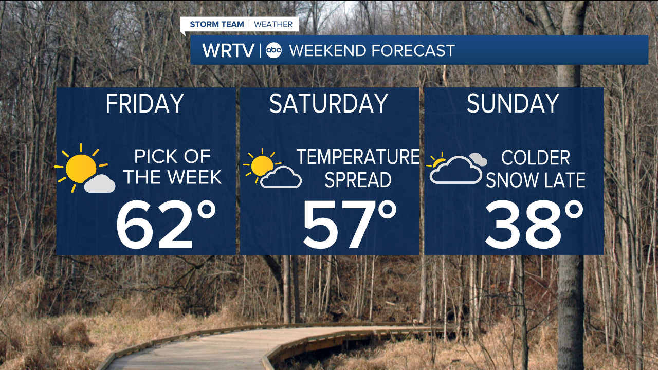
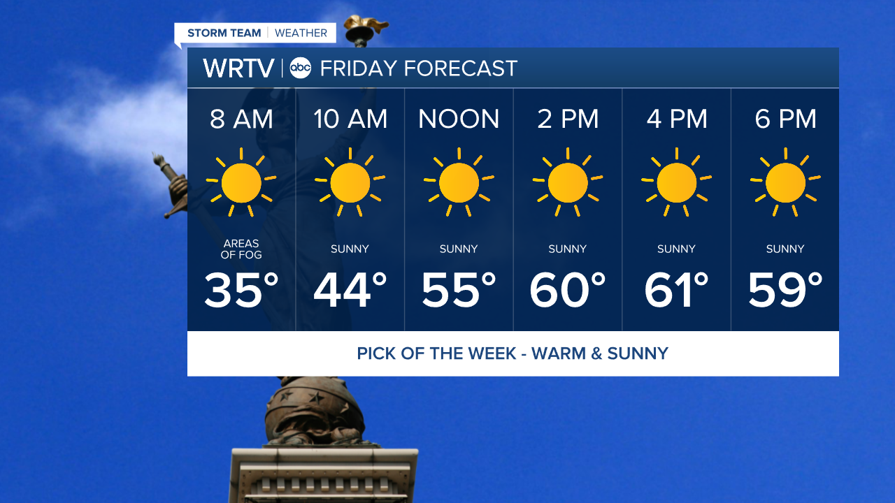
- 60'S WITH SUNSHINE FOR OUR FRIDAY
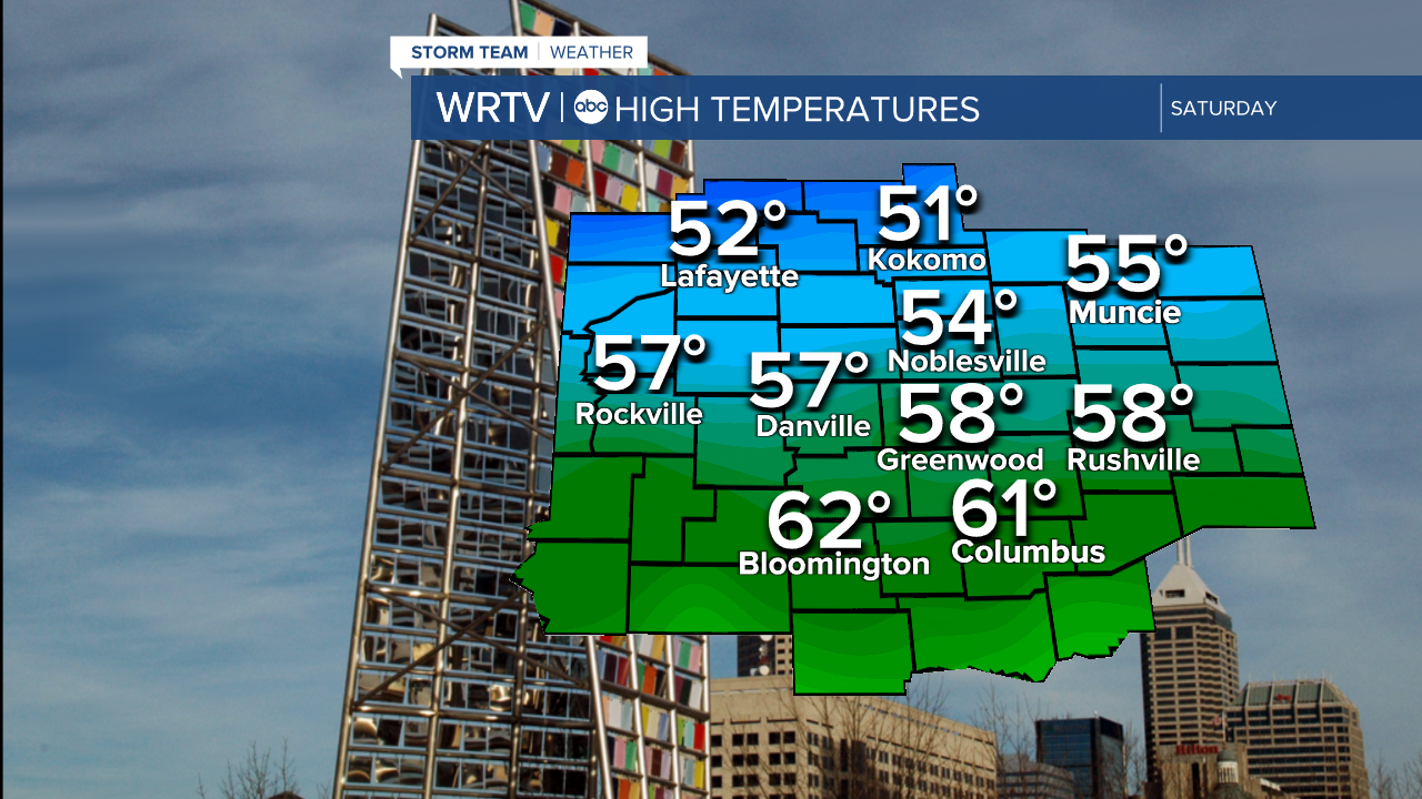
- MILD BUT BIG TEMP SPREAD NORTH TO SOUTH SATURDAY
- SOME ACCUMULATING SNOW POSSIBLE MONDAY
It’s going to be a pretty wild stretch of weather across the area over the next week and a half—a little spring and a little winter in the mix as the seasons transition. Let's start with the good news: Friday will be the best day of the week. Expect sunshine and temperatures climbing into the low 60s for most of the area. There could be a touch of fog in the morning, but otherwise, it looks to be a great day.
Saturday will still be fairly nice as well. A front will move through and may potentially stall, resulting in a fairly large temperature spread across the area—low 50s to the north and low 60s to the south. Skies will be partly cloudy.
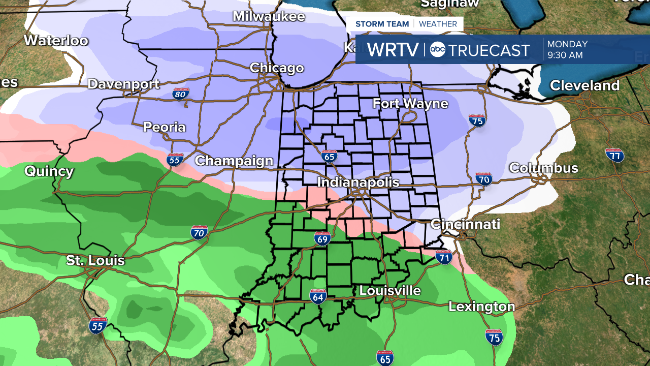
As we move from Sunday into next week, a storm will bring a wintry mix to the area. Several inches of snow will be possible with this system. Right now, it looks like the best chance of snow will be to the north, with more of a mix as you move south. Details will be ironed out as we get closer, but I just wanted to give you a heads up.
Once that system moves through, there will be the potential for a lot of rain by the end of next week. It will trend much warmer, but you'll need your rain gear.
Indianapolis Weather Forecast:
Overnight: Mainly clear. Patchy fog. Low: 33°
Friday: Mostly sunny. High: 62°
Saturday: Partly cloudy. High: 57°
Sunday: Mostly cloudy. Colder. Snow late. High: 38°
Monday: Rain/Snow mix. High: 36°
Indianapolis 7-Day Weather Forecast