


Headlines
- WARM AND DRY ALL WEEK
- WARMEST DAY IS TUESDAY
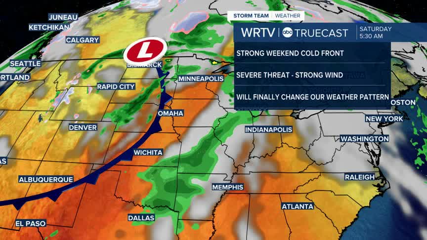
- STRONG COLD FRONT SATURDAY. SEVERE STORMS POSSIBLE
Tuesday will be the warmest day of the week. We'll start in the 50s, but highs will reach the upper 70s to low 80s under mostly sunny skies. It will be another great day to get outside and enjoy the fall weather.

The rest of the week will be dry. However, we will need to keep an eye on a strong storm and trailing cold front that are expected to move through the area sometime between Saturday and Sunday. We will fine-tune the timing as we get closer, but strong winds and possibly even some severe weather will be possible.

Behind this front, temperatures will be much more seasonable, in the 60s. This front could also break up the stubborn weather pattern we have been experiencing with warm and dry conditions. It will likely become more active toward the end of the month and into November.
Indianapolis Weather Forecast:
Overnight: Partly cloudy. Low: 53°
Tuesday: Sunny & warm. High: 79°
Wednesday: Partly cloudy. High: 73°
Thursday: Mostly sunny. High: 72°
Indianapolis 7-Day Weather Forecast

