


Headlines
- STILL CHILLY TOMORROW
- WINTRY MIX POSSIBLE THURSDAY MORNING
- 60° POSSIBLE BY THE WEEKEND
Temperatures will be on the upswing over the next few days. Tuesday will once again feature quite a bit of cloud cover. It will start off cold, with temperatures rising to seasonable highs in the low 40s by afternoon. However, the lack of sunshine and the breeze will make it feel a bit colder.

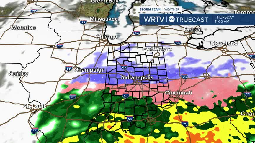
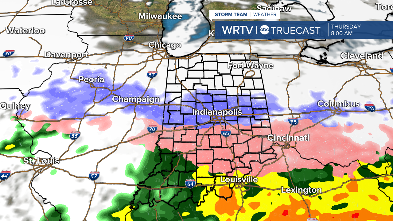
As we look ahead to the end of the week, one thing we will have to keep an eye on is Thursday morning. A storm moving just to our south will bring the chance of snow to the north, a mix through the central portion of the state, and rain to the south. We'll fine-tune the forecast as we get closer, but just know that Thursday morning could be a bit slick for some. By the afternoon, though, temperatures will be in the 40s, so slippery conditions should fade as the day goes on.
Once we get past Thursday, temperatures will really start to warm up. We'll be in the low 50s on Friday, and Saturday will be the warmest day of the week, with highs close to 60°.

It will just be a one day deal though, we turn colder again heading into the start of next week.
Indianapolis Weather Forecast:
Overnight: Mostly cloudy Low: 20°
Tomorrow: Mostly cloudy High: 42°
Wednesday: Mostly sunny. High: 48°
Thursday: AM Wintry Mix. High: 41°
Friday: Sunshine. Warmer. High: 53°
Indianapolis 7-Day Weather Forecast

