


Headlines
- NOT AS BITTER COLD OVERNIGHT
- WARMING TREND THROUGH THURSDAY
- NEXT STORM IS MAINLY RAIN
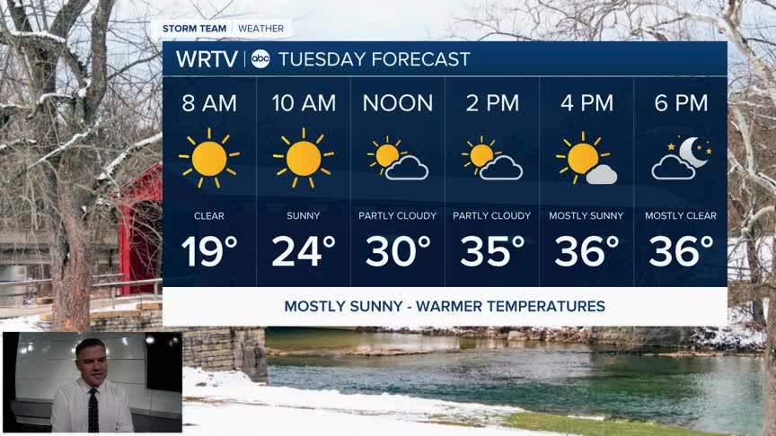
After record low temperatures this morning, when almost everyone was below zero, it will still be cold overnight, but not nearly as cold as Monday morning. Look for low temperatures to be in the mid to upper teens as you start your Tuesday. Skies will be partly cloudy as well.

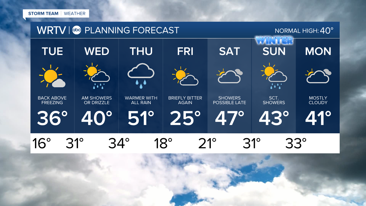
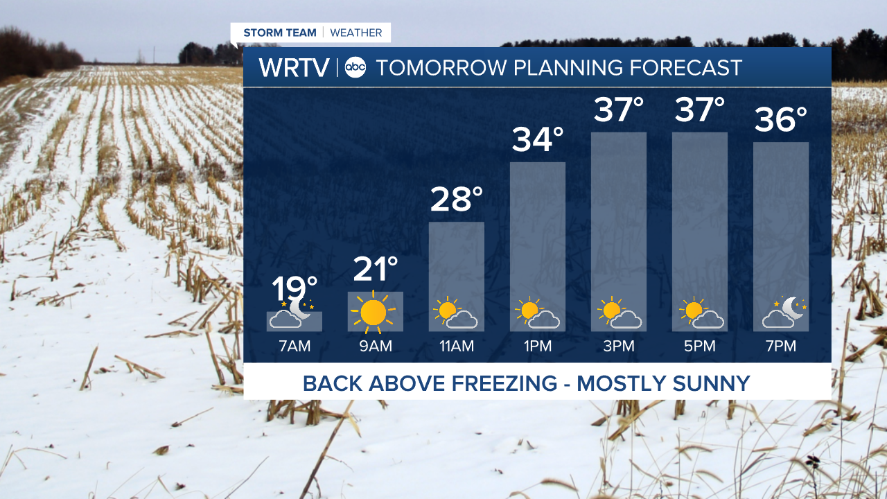
Once we get to tomorrow afternoon, we will be back above freezing. This warming trend will continue into Thursday. The combination of sunshine and above-freezing temperatures should start to put a dent in our snow pack by Tuesday evening.
Wednesday morning, we may have to keep an eye on a very brief and light wintry mix as warmer air moves in. It shouldn't last long, and then most of Wednesday will be dry. Thursday will be the warmest day of the week, but it will come with a good amount of rain across the area. A few rumbles of thunder will be possible as well. As the storm departs, there could be a change back to some wintry weather as cold air rushes back in Thursday night—something we will continue to monitor.
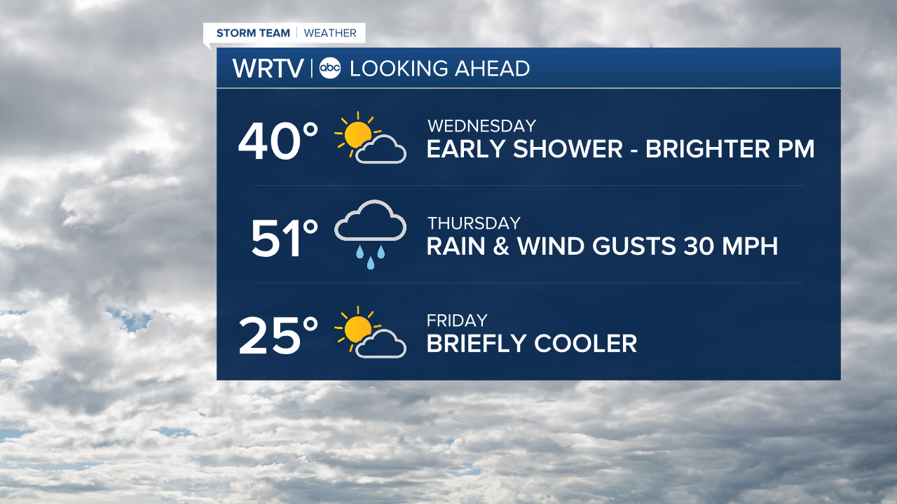
Friday will be another very cold day for us, but it’s just a one-day event. We return to the 40s for the weekend.
Indianapolis Weather Forecast:
Overnight: Mainly clear. Cold, but not as bitter Low: 16°
Tuesday: Mostly sunny. High: 36°
Wednesday: Brief AM Mix? Then partly cloudy. High: 40°
Thursday: Rain. Could be heavy at times. Windy. High: 51°
Friday: Briefly bitter once again. High: 25°
Indianapolis 7-Day Weather Forecast