Headlines
- WARMING TREND INTO THE WEEKEND
- A FEW SHOWERS POSSIBLE THURSDAY MORNING
- 70S FOR MOST OVER FRIDAY, SATURDAY AND SUNDAY
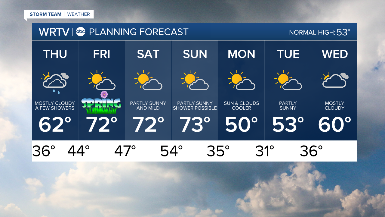
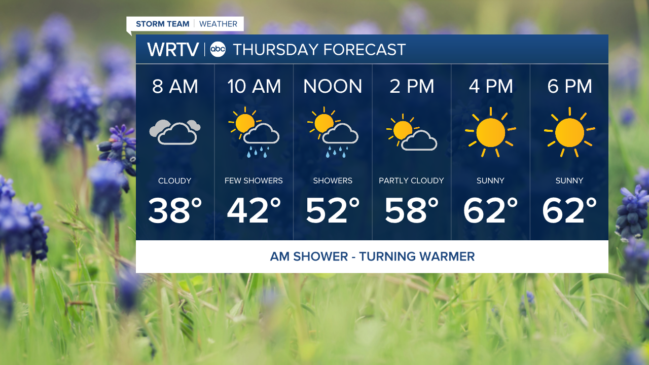
We will warm up quickly on Thursday, but be on the lookout for a few showers mid-morning. They will be light and scattered, with the best chance of seeing them north and east of Indy. Areas to the south should remain mainly dry, with partly cloudy skies. Highs will eventually climb into the low 60s, with skies becoming mostly sunny for everyone.
As we look ahead to the weekend, temperatures will warm right on cue. Spring officially arrives at 10:46 AM, and highs will be in the low 70s on Friday afternoon with partly cloudy skies.

Saturday will be just as warm for everyone. However, some areas south of I-70 may have a chance to reach 80°. To the north, it might be a bit cooler in the upper 60s, but still above normal for this time of year. Sunday will also be mild, with just a chance of a few light showers.
Indianapolis Weather Forecast:
Overnight: Mostly cloudy. Low: 36°
Thursday: Spot am shower. Then partly cloudy High: 62°
Friday: Partly cloudy. High: 72°
Saturday: Sun & clouds. High: 73°
Sunday: Partly cloudy - Spot shower possible. High: 73°
Indianapolis 7-Day Weather Forecast