


Headlines
- RAIN OVERNIGHT INTO THE MORNING COMMUTE
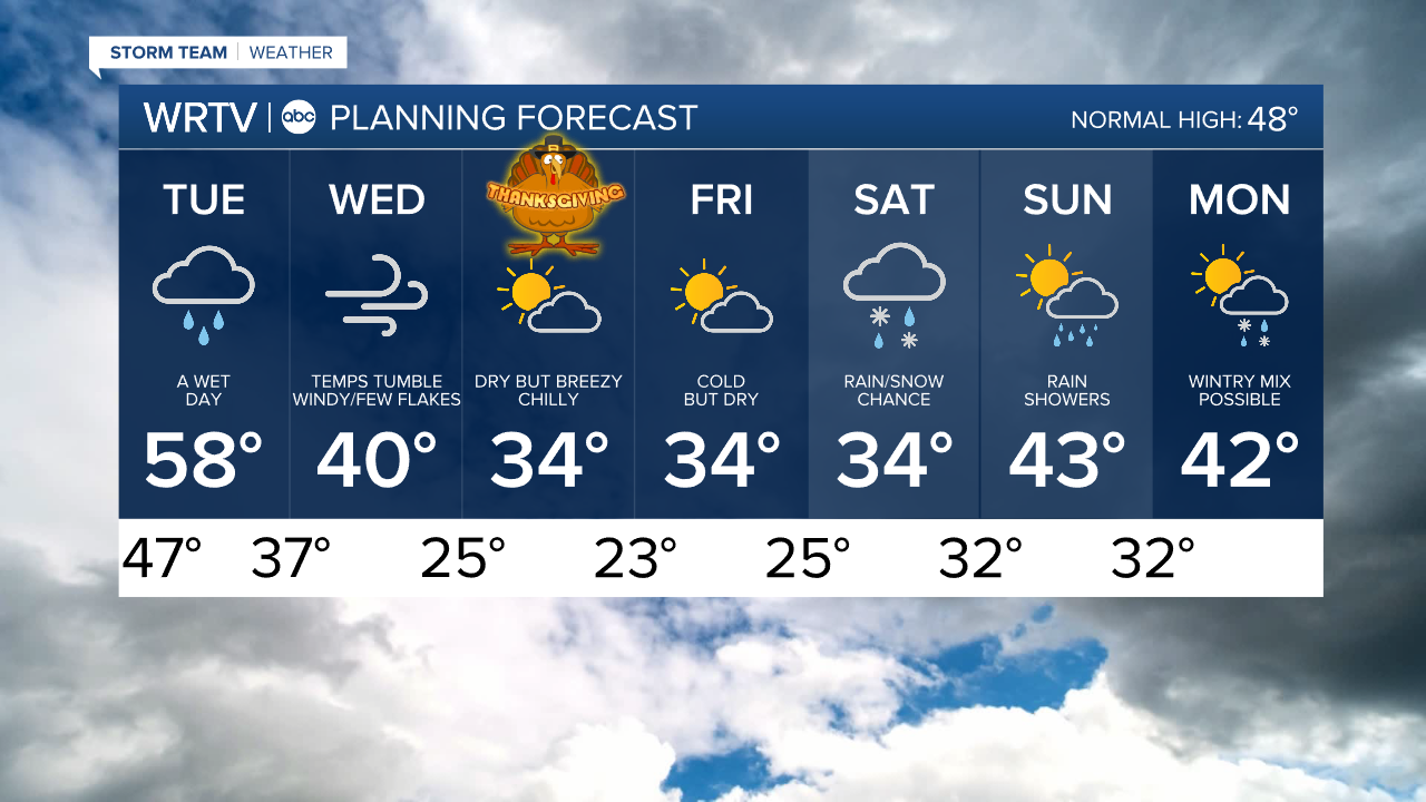
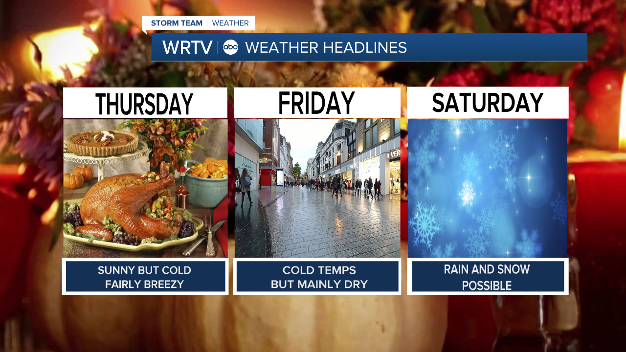
- COLD BUT DRY THANKSGIVING & BLACK FRIDAY
- RAIN/SNOW MIX POSSIBLE ON SATURDAY
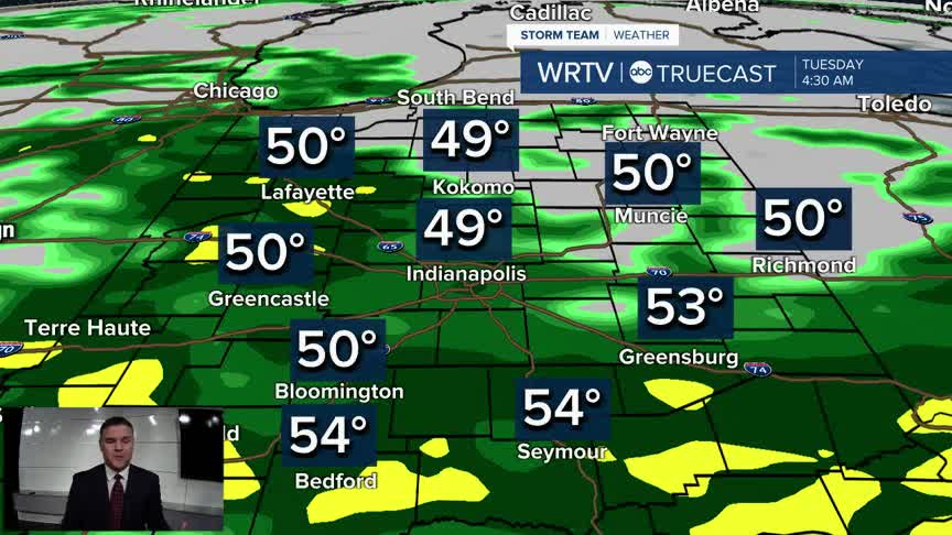
Rain chances will increase late this evening and continue overnight into the Tuesday morning commute. The rain will be fairly steady but light in intensity. Temperatures will remain well above freezing, so this will be an all-rain event.
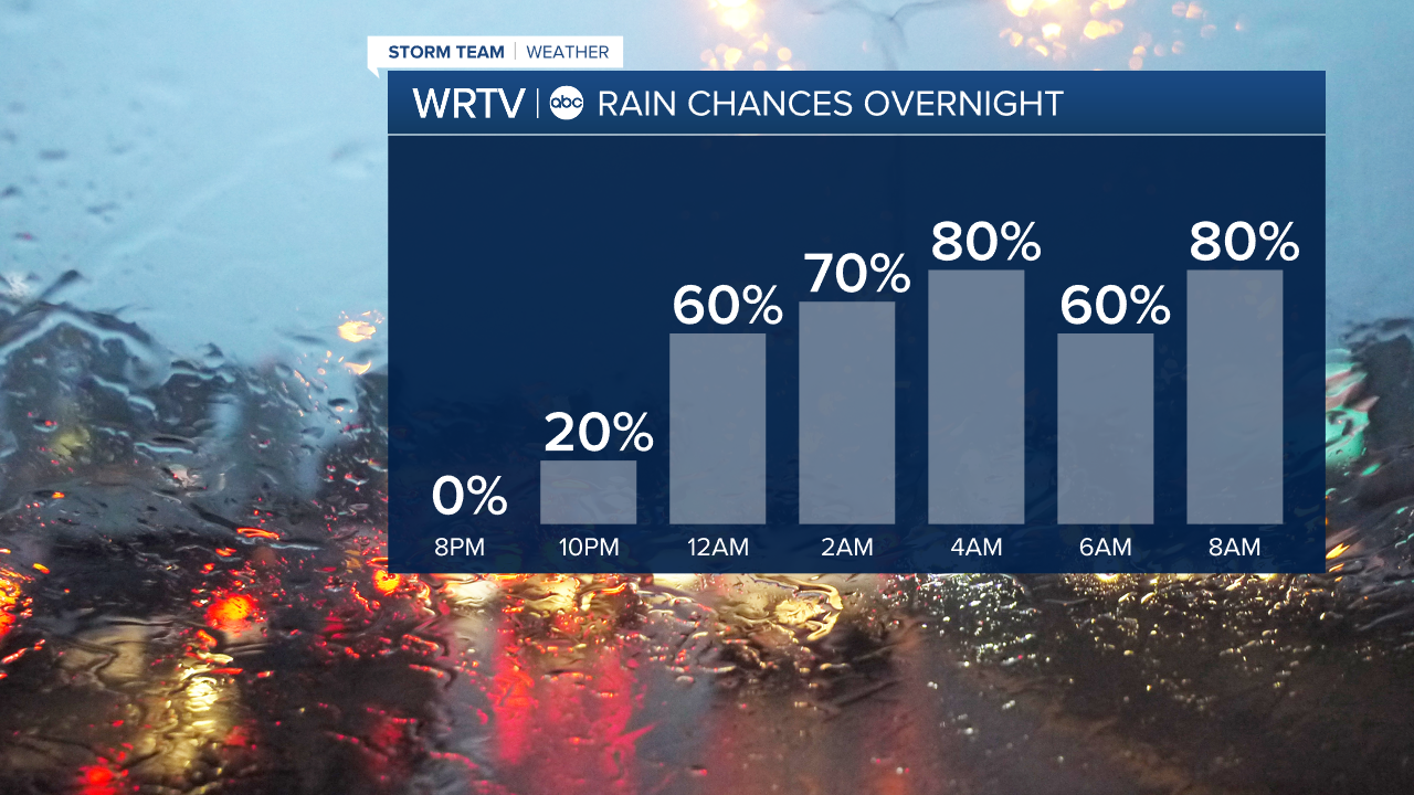
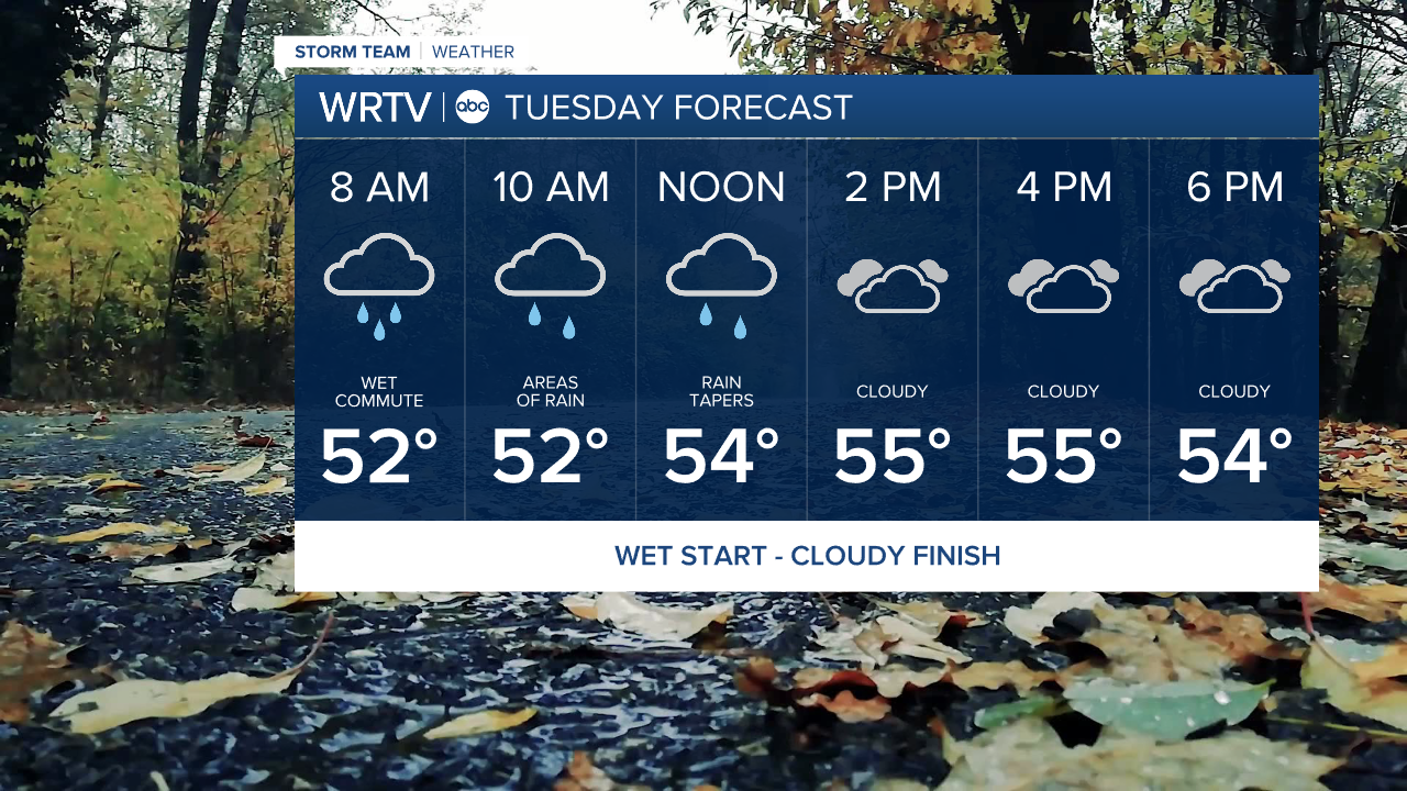
Give yourself some extra time for your morning drive on Tuesday, as the roads will be wet. The rain will taper off to scattered showers by noon, followed by lots of clouds in the afternoon. A few sprinkles will be possible later in the day, but nothing heavy or widespread is expected. Temperatures will be in the mid to upper 50s.
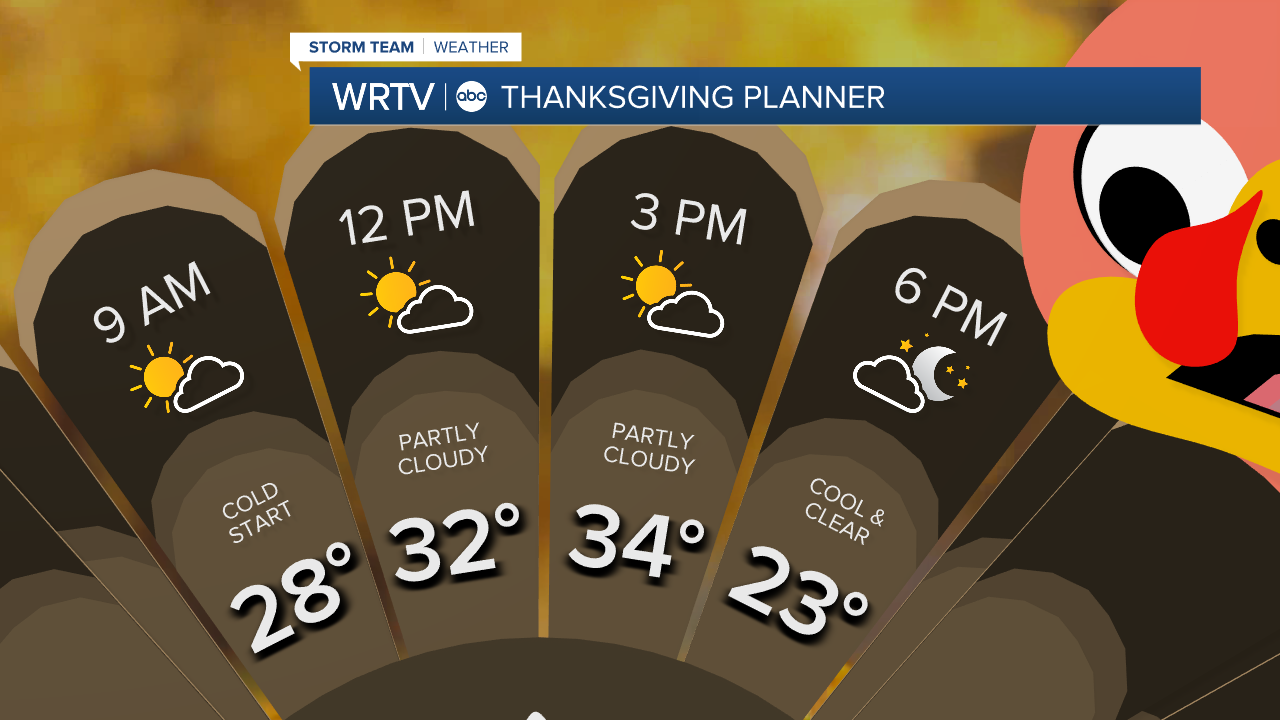
Wednesday is when things really start to change. A cold front will drop temperatures, with highs averaging around 40°F. Winds could gust up to 30 mph, making it feel much colder. A few snow showers are possible as well, but no accumulation is expected. Thanksgiving will be dry, breezy, and cold, with highs struggling to get above freezing.
The weather on Friday will be very similar to Thanksgiving, with highs in the low 30s after starting in the 20s. Looking ahead to Saturday, a storm could bring a mix of rain and snow to the area. This is worth noting for holiday travel, but we are still too far out to discuss potential snow amounts. There are still too many variables to sort out.
Indianapolis Weather Forecast:
Overnight: Rain. Low: 47°
Tuesday: Morning rain then cloudy with spot shower. High: 58°
Wednesday: Temps tumble. Mostly cloudy & very windy. A few flakes. High" 40°
Thanksgiving: Cold and breezy but dry. High: 34°
Friday: Partly cloudy. High: 34°
Saturday: Rain/snow possible. High: 34°
Indianapolis 7-Day Weather Forecast