


Headlines
- RAIN & THUNDERSTORMS FRIDAY MORNING
- NEAR RECORD WARM FRIDAY
- MORE RAIN & STORMS SATURDAY
Central Indiana is not done with the rain just yet.
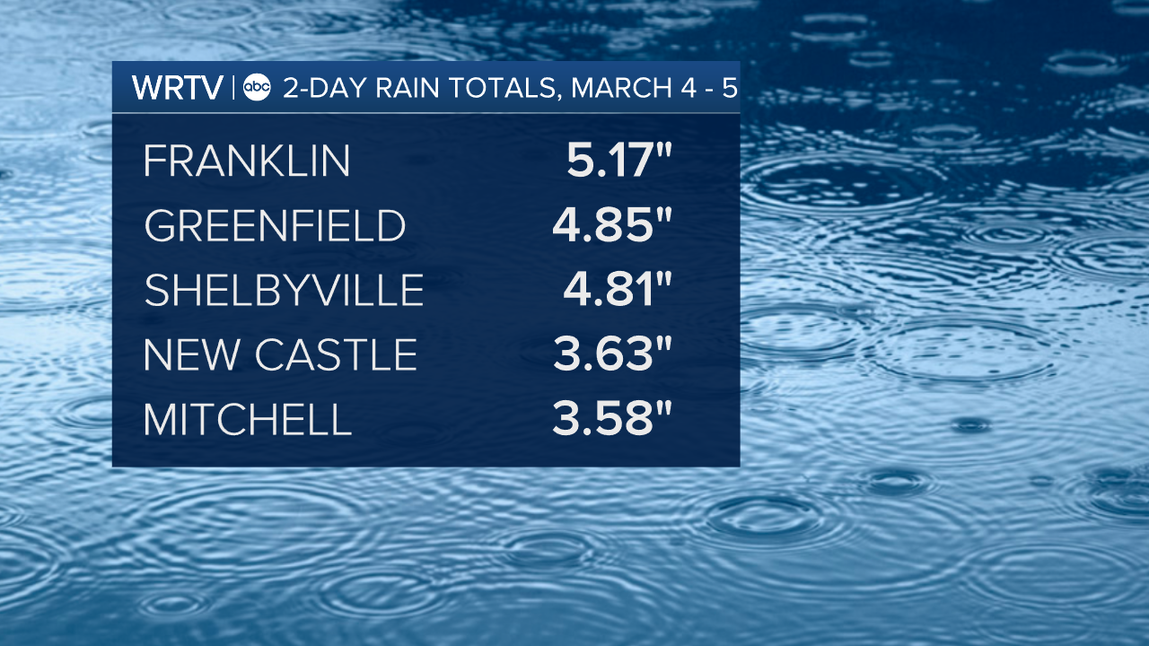
2-day rain totals from March 4 and 5 range anywhere from 2-5" of rain.
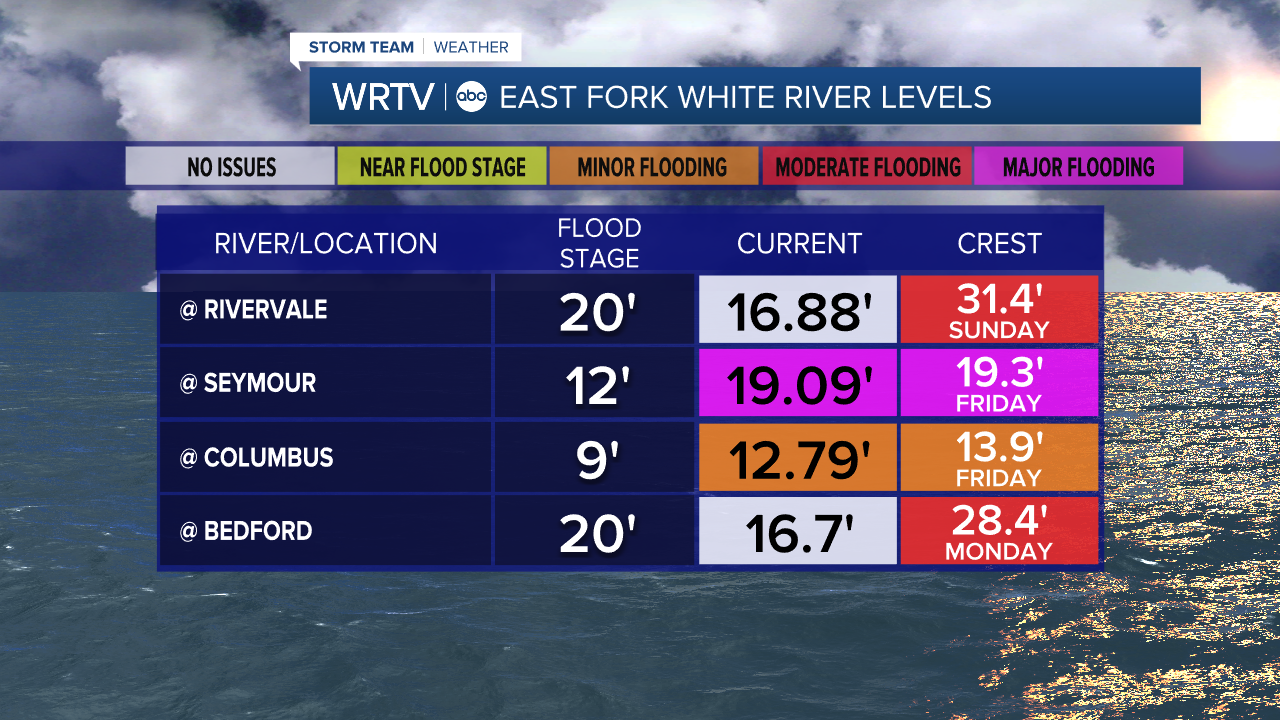
Some rivers are already flooding. Because we have more rain Friday and Saturday, many rivers may not crest until Sunday or Monday.
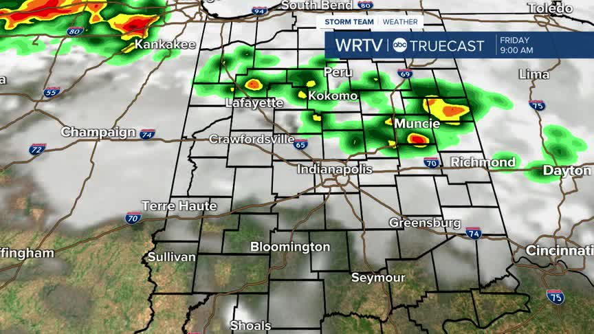
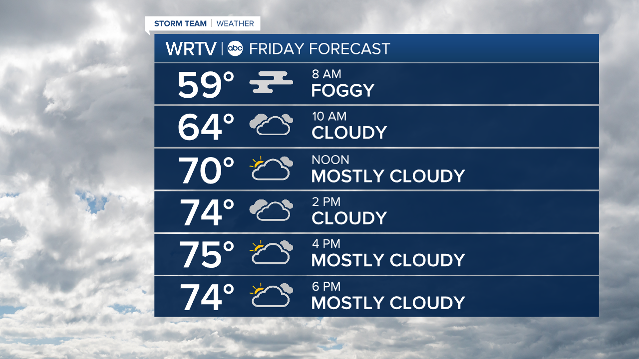
Friday will not be a wash, but it starts with some rain and thunderstorms in the morning. Patchy dense fog is also likely in the morning. Give yourself some extra drive time in the morning, and have an umbrella ready to go.
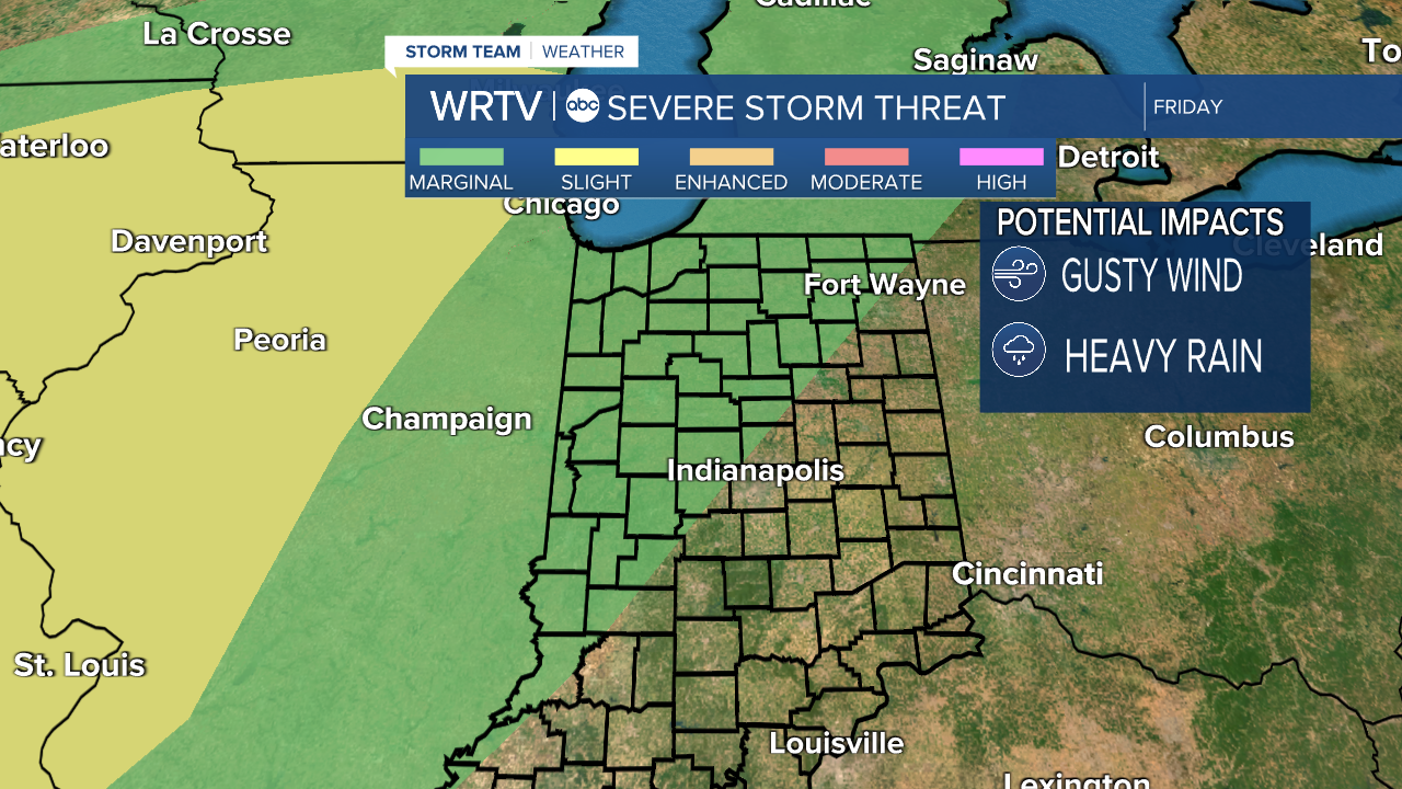
There is a marginal risk of severe weather Friday, with gusty winds being the primary concern. Hail could be possible in addition to brief pockets of heavy rain.
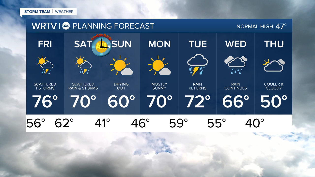
Friday afternoon we see a lull from the rain with mostly cloudy skies. Temperatures are near record level: the previous record high for March 6 was 75° in 1973, but we are forecast for 76° in Indianapolis.
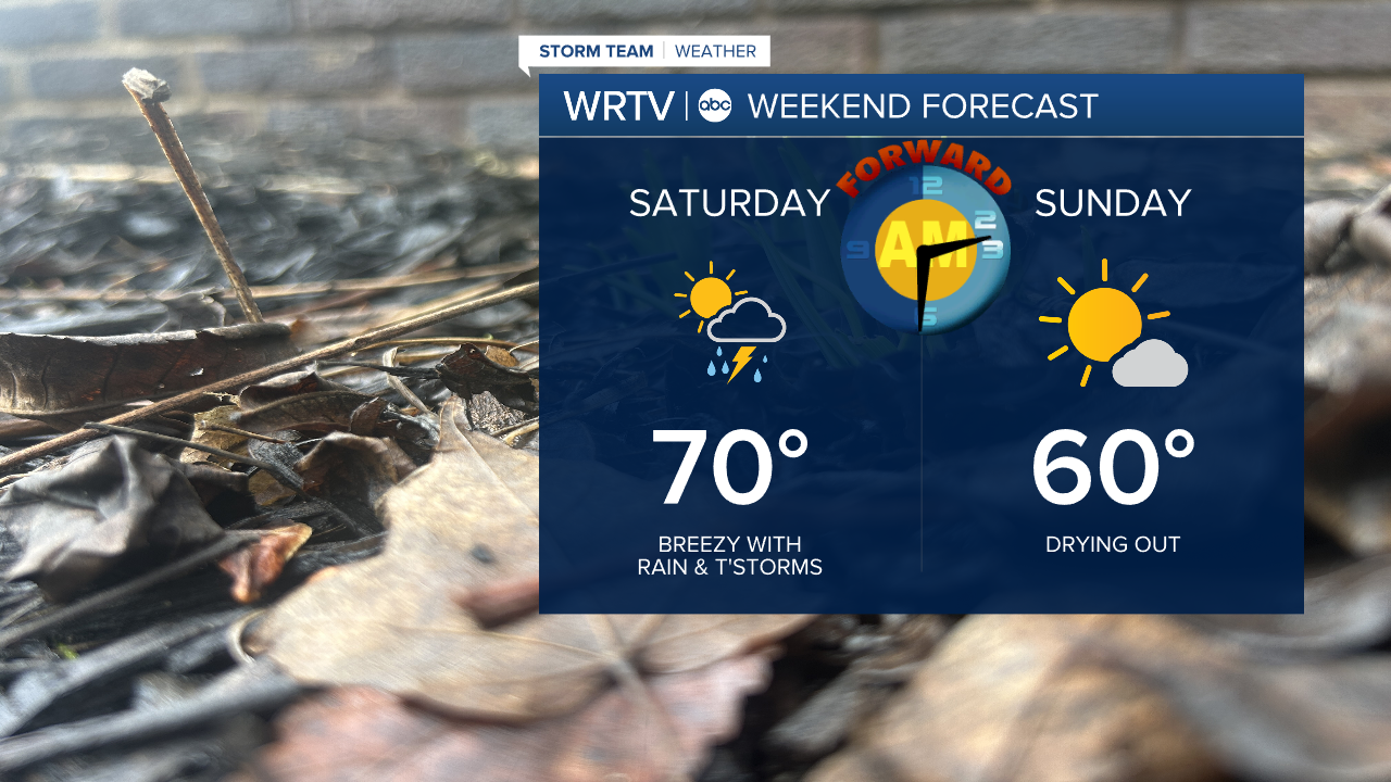
Saturday morning another round of rain and thunderstorms will pass through Central Indiana. This will again pose a marginal risk for severe weather, with gusty winds being the main concern.
Between Friday and Saturday, some areas could pick up another inch of rain, adding to already existing flood concerns.
Saturday afternoon we begin to dry out. Highs are near 70°.
Don't forget Daylight Saving Time begins Sunday, as we jump from 2 a.m. to 3 a.m. and lose an hour of sleep.
Sunday will be cooler with a high near 60°, but the day looks dry with some much-needed sunshine.
Indianapolis Weather Forecast:
Tonight: Patchy dense fog. Rain & thunderstorms late. Low: 56°
Friday: Scattered AM rain & thunderstorms. Mostly cloudy afternoon. High: 76°
Saturday: AM rain & thunderstorms. Breezy. High: 70°
Sunday: Mostly sunny. High: 60°
Indianapolis 7-Day Weather Forecast