


Headlines
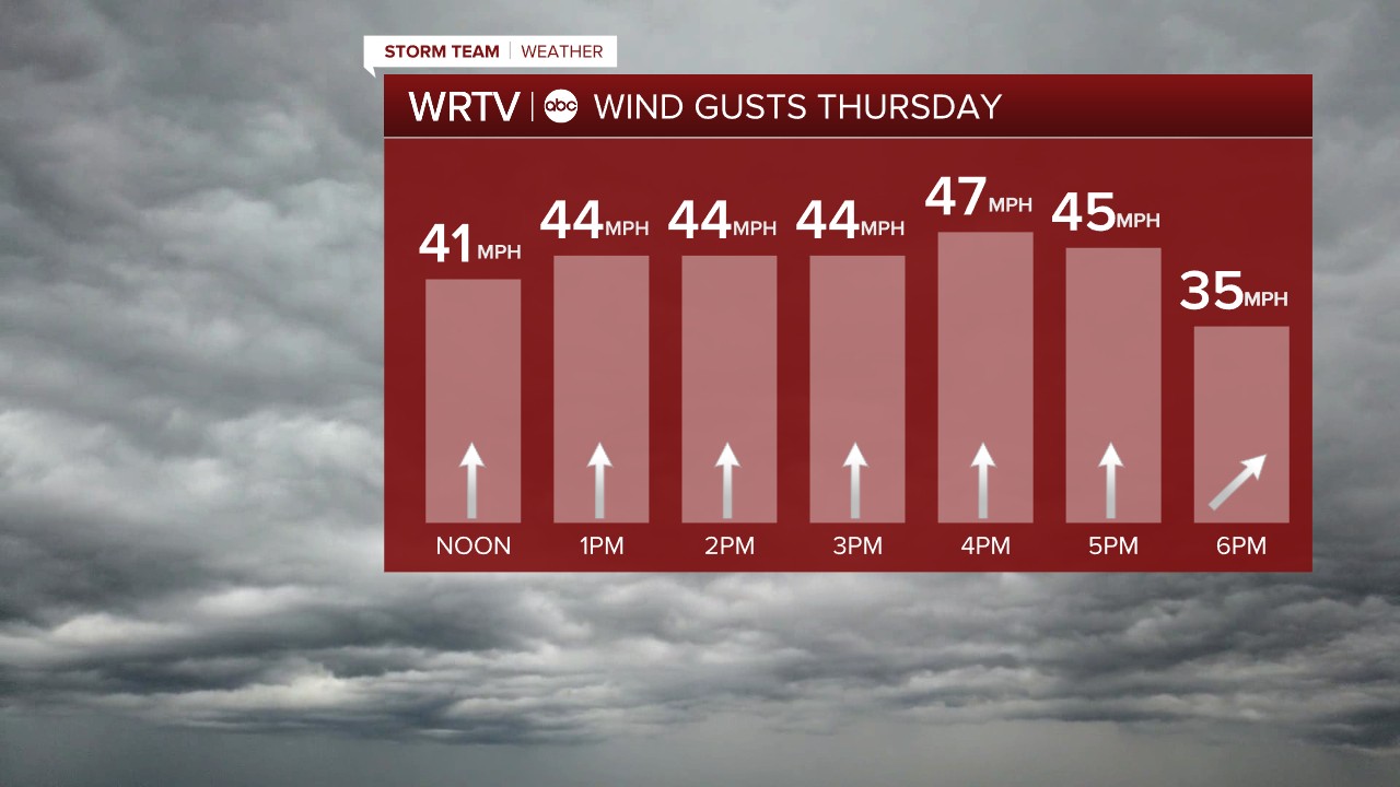
- WIND ADVISORY THROUGH 8 P.M. THURSDAY
- HEAVY RAIN DURING EVENING COMMUTE
- FLASH FREEZE TONIGHT
Thursday is a Storm Team Alert Day. Impacts today include heavy rain and wind gusts 40 - 45 mph. The forecast remains impactful as temperatures crash quickly overnight, leading to icy roads Friday morning.
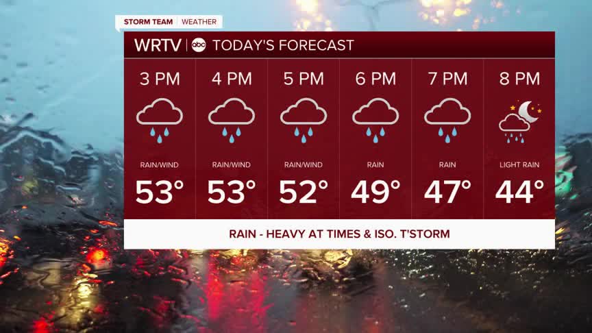
Scattered showers continue this afternoon. A line of heavier rain, and possibly a few thunderstorms, moves across the state this evening, likely around the time of the evening commute. The falling rain will slow down your evening commute. Some ponding is possible on the roads.

A wind advisory has been issued for Central Indiana, as wind gusts 40+ mph are possible. Make sure any holiday decorations and lights are secure in your yard.
The steady rain exits this evening, but a few showers could linger into the overnight. As temperatures crash, precipitation will change into snow showers by early Friday morning.

Temperatures fall near the freezing mark by midnight. The wet roads will become icy overnight. Temperatures continue to drop into the 20s. Prepare for a slick Friday morning commute.
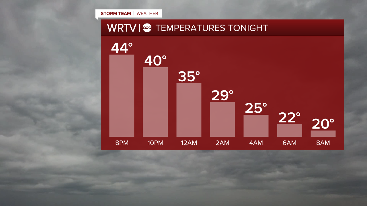

Wind chills tomorrow morning are in the single digits. The day is dry with some clouds breaking. Highs are in the 20s.
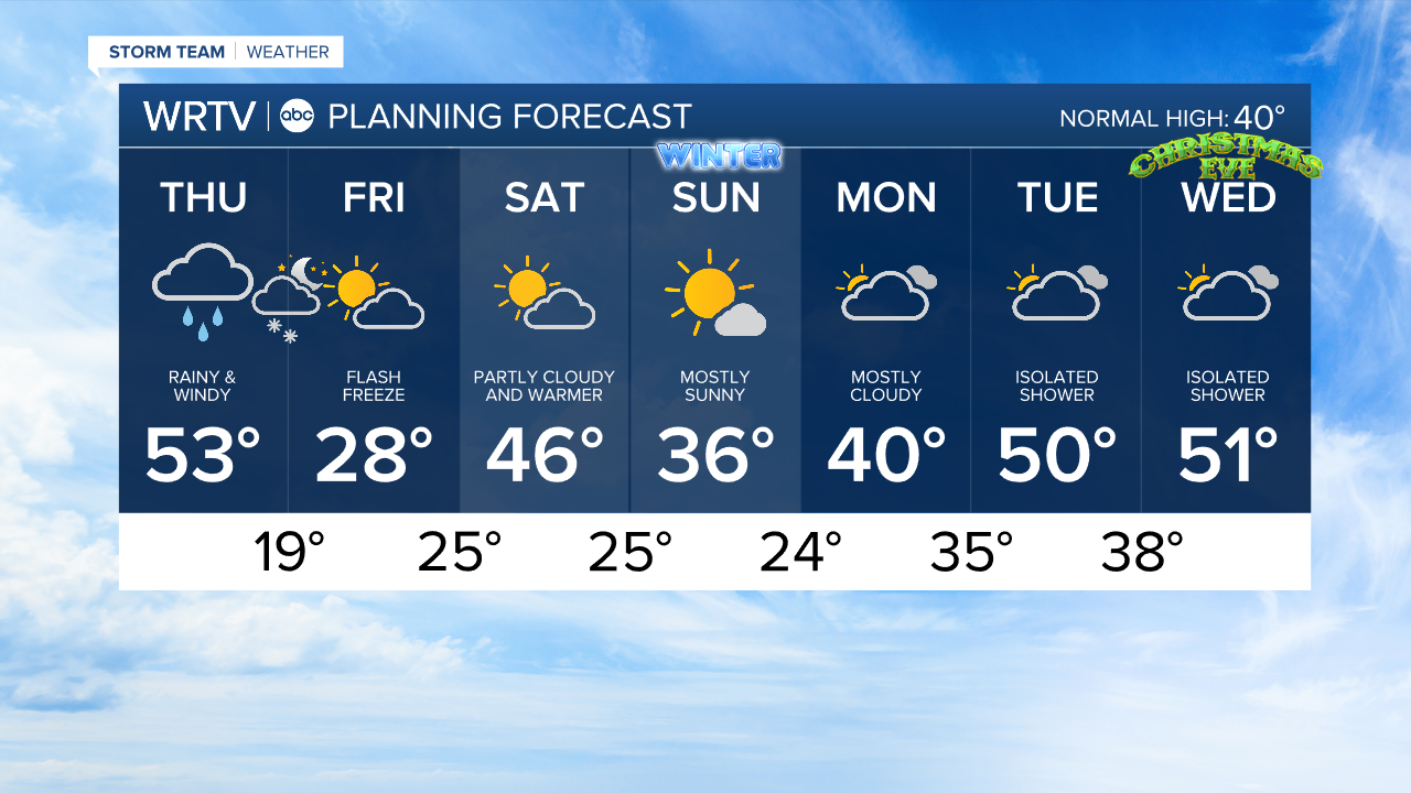
Temperatures start to climb again this weekend.
Indianapolis Weather Forecast:
Today: Rain, heavy at times. Wind gusts 40+ mph. High: 53°
Overnight: Scattered snow showers. Flash freeze likely. Low: 19°
Friday: Icy start. Staying cold. High: 28°
Indianapolis 7-Day Weather Forecast