


Headlines
- BIG TEMPERATURE SPREAD SATURDAY
- SNOW POSSIBLE MONDAY MORNING
- THEN VERY WET BUT WARMER MUCH OF NEXT WEEK
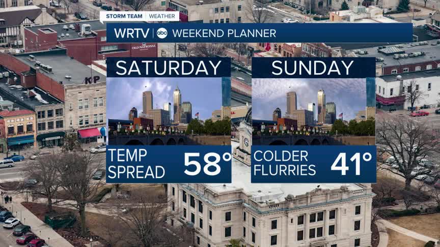
Overall, Saturday will be a really nice day for us, with partly cloudy skies. However, depending on where you live, temperatures will vary significantly as a warm front will be draped across the area. To the north, highs will only reach the upper 40s. To the south, you can look forward to a great day with highs in the low 60s.

Sunday will be much colder, with temperatures in the 40s and a few flurries or showers as the colder air moves in. A wave of heavier moisture will arrive on Monday, bringing a wintry mix to the area. Some light snow accumulation of 1" to 3" will be possible. However, models have been trending lighter with the precipitation and shifting the storm further south. Any issues would likely only occur on Monday morning, as temperatures will rise into the low 40s by the end of the day.

That storm, however, will open the door to a parade of storms moving through the area next week. In fact, we could be talking about some flooding by the end of the week, with some areas seeing 3" to 5" of rain.

The good news is it will be warmer, as highs will climb from the 40s at the start of the week to near 70° by the end of the week. Some thunderstorms will also be possible as the week progresses.
Indianapolis Weather Forecast:
Saturday: Partly cloudy. Big temperature spread High: 58°
Sunday: Mostly cloudy/ Flurry/Sprinkle. High: 41°
Monday: Wintry mix to rain. High: 41°
Tuesday: Areas of rain. High: 55°
Wednesday: Rain. High: 60°
Indianapolis 7-Day Weather Forecast

