


Headlines
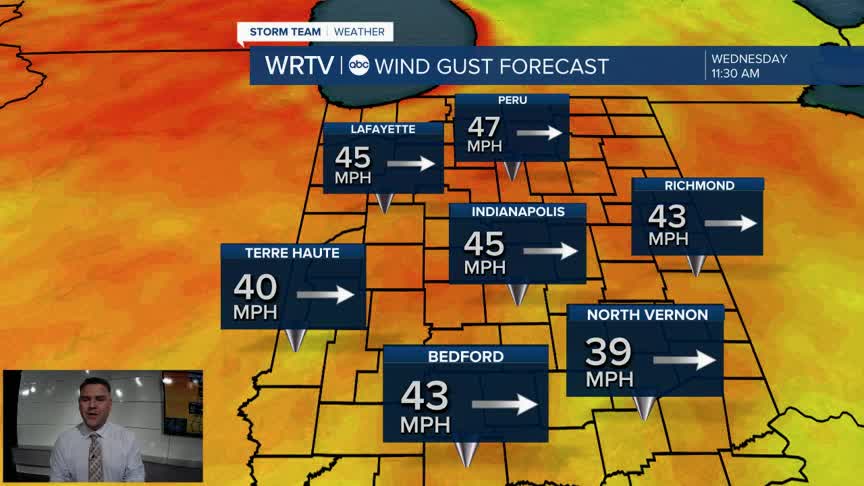
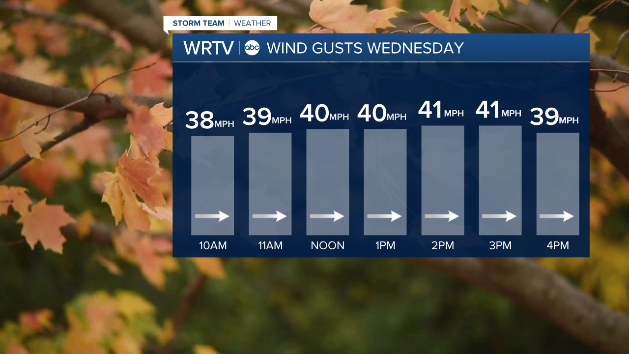
- WIND ADVISORY WEDNESDAY - GUSTS OVER 40 MPH
- VERY COLD HOLIDAY WEEKEND
- WATCHING A WINTRY FOR SATURDAY/SUNDAY
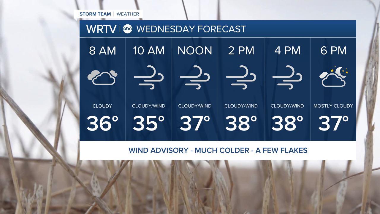
Big changes are heading our way overnight as a front moves through. Temperatures will tumble, and the wind will become extremely strong. A Wind Advisory is in place for most of the state throughout the day on Wednesday. Wind gusts will likely exceed 40 mph for much of the afternoon.
High temperatures on Wednesday will officially go into the record books just after midnight. It will be in the 30s for most of Wednesday afternoon. Factoring in the wind, it will feel like the low 20s, so be sure to bundle up.
Thanksgiving will be one of the coldest we’ve seen in about 10 years. Highs will struggle to get above freezing. Morning wind chills will be in the teens, rising into the 20s through much of the afternoon. It will be a dry day, however, with partly cloudy skies.

Friday will be very similar to Thanksgiving, with highs in the low to mid-30s. Wind chills will be even colder, and a few snow showers are possible late in the day. Our attention will then turn to a weekend storm. It is currently trending further north, and many details still need to be worked out. At this point, though, there is a chance of accumulating snow from Saturday into Sunday, at least in northern areas, before everyone transitions to rain. The forecast will change and will need to be fine-tuned, but I just wanted to give a heads up for those traveling.

Indianapolis Weather Forecast:
Overnight: Temps tumble. Becomes very windy. Low: 36°
Wednesday: Gusts over 40 mph. Partly cloudy with a few snow showers. High: 38°
Thanksgiving: Partly cloudy - Breezy. High: 34°
Friday: Mostly sunny. Some snow showers late. High: 34°
Saturday: Wintry Mix. High: 37°
Indianapolis 7-Day Weather Forecast

