Headlines
- CALM AND SEASONABLE SATURDAY
- SEVERE THREAT SUNDAY NIGHT
- SNOW SHOWERS MONDAY AND BELOW FREEZING TEMPS
As we look ahead to Saturday, there are a lot of St. Patrick's Day events taking place, and the weather should cooperate for all of them. Expect lighter winds, partly sunny skies, and seasonable temperatures around 50°.

Sunday temperatures will rise into the low 70s, and the wind will pick up throughout the day. Most of the day will be dry, so you'll be able to get out and enjoy the warmth. However, you will need to be weather-aware in the evening and overnight once again, as another strong cold front will move through with the potential for severe weather. The entire state is under a "Slight Risk" for severe storms, while a large portion has been elevated to a higher category, the "Elevated Risk."
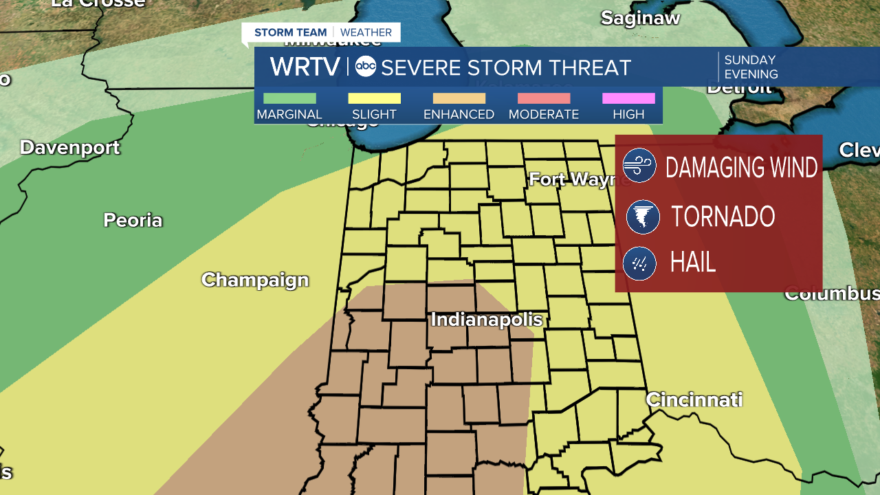
Look for a line of storms to come through and produce very strong winds, with a few tornadoes possible as well. Hail should not be much of a threat. For some of you, this will occur while you are sleeping, so you have some time to prepare. Power outages will be possible, so make sure all your devices are charged and that you have a way to receive warnings.

Once the front passes, temperatures will drop nearly 50° in a very short period of time, and on Monday, snow showers will be possible with some minor accumulation. Thankfully, we will avoid any significant snow, but slick spots will be possible.
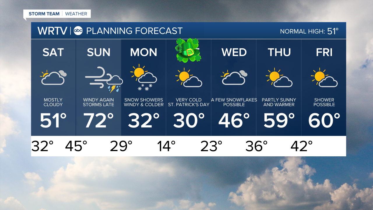
Indianapolis Weather Forecast:
Saturday: Partly cloudy. Seasonable High: 51°
Sunday: Partly cloudy. Warm & windy. Severe storms late. High: 72°
Monday: Snow showers. Cold. High: 32°
Indianapolis 7-Day Weather Forecast