


Headlines
- BITTER COLD WIND CHILLS
- HEAVY SNOW THIS WEEKEND
- COLD AIR HOLDING INTO NEXT WEEK
Bitter cold air is in place Friday through next week. Temperatures are expected to drop into the single digit range to near 0°. When you factor in the wind it will feel anywhere from 5°-15° below zero in central Indiana and 15°-25° below zero a bit farther north. Then our focus shifts to snow expected Saturday into Sunday where we have a winter storm warning in place.

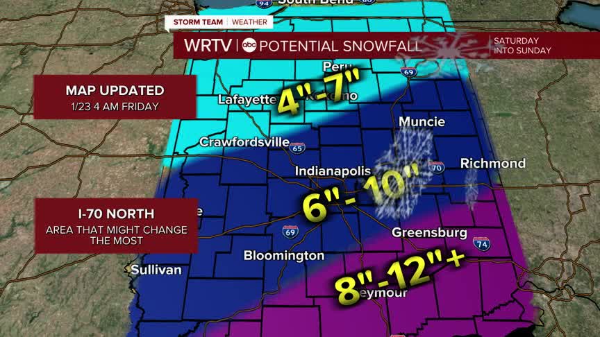
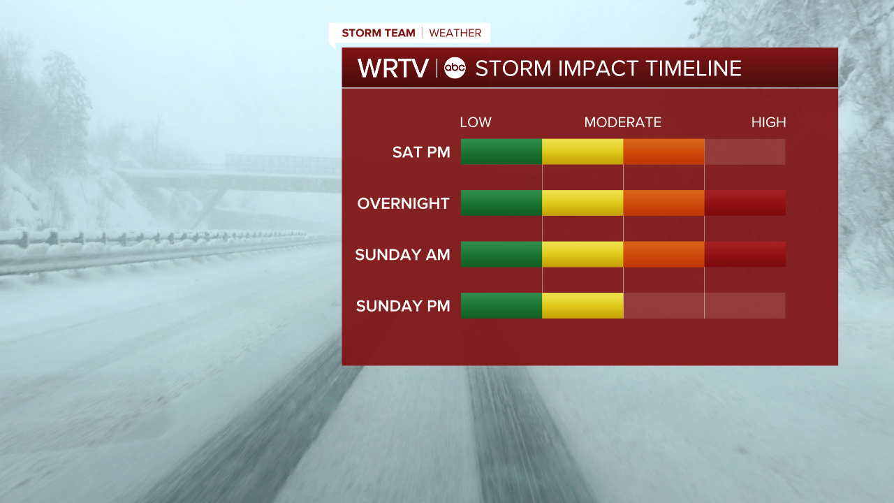
Most of our area looks to land in the 6"-10" range. That will be storm total by midday Sunday. We will start to see snow by Saturday afternoon with most of the snow expected to fall overnight into Sunday morning. We will keep a close on on the forecast heading into the weekend. The area that will most likely need adjustments is north of I-70. When snow fills mixes with air this cold it can sometimes evaporate and cut into totals.
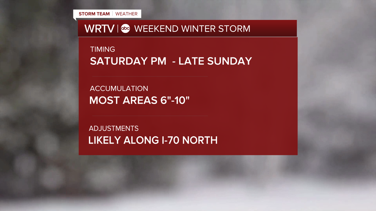
If you have Saturday plans, the general rule is the earlier the better. If you plan to leave Saturday afternoon and especially the evening be prepared for roads to become snow covered. The biggest travel impacts will be Saturday night and Sunday morning.
Very cold air sticks around into next week. Overnight lows will be at or below 0° at times. High temperatures make it back to the 20s by Tuesday with colder air back by Thursday.
For a county by county forecast, check here: County-by-county forecast
Indianapolis Weather Forecast:
Today: Partly cloudy. High: 11°
Overnight: Partly cloudy. Low: 1°
Tomorrow: Afternoon/evening snow. High: 12°
Indianapolis 7-Day Weather Forecast

