


Headlines
- WINTER WEATHER ADVISORY THROUGH 7 A.M. TUESDAY
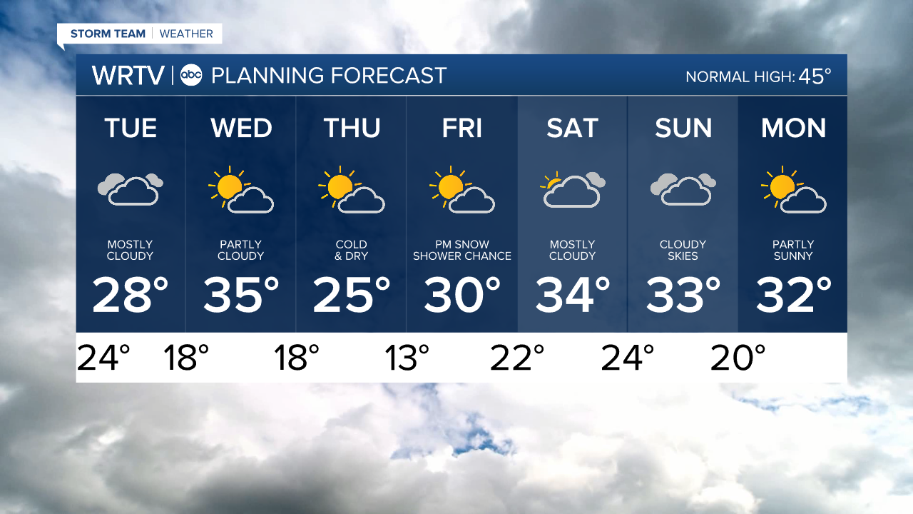
- VERY COLD WEEK
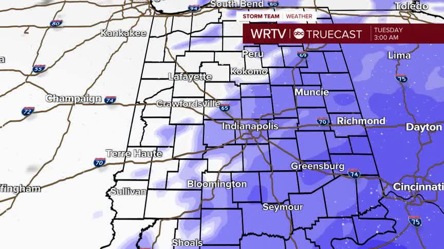
Snow continues to fall overnight and into early Tuesday morning. Roads will continue to be slick and snow-covered, but snow will stop falling before normal morning commute hours.
WRTV
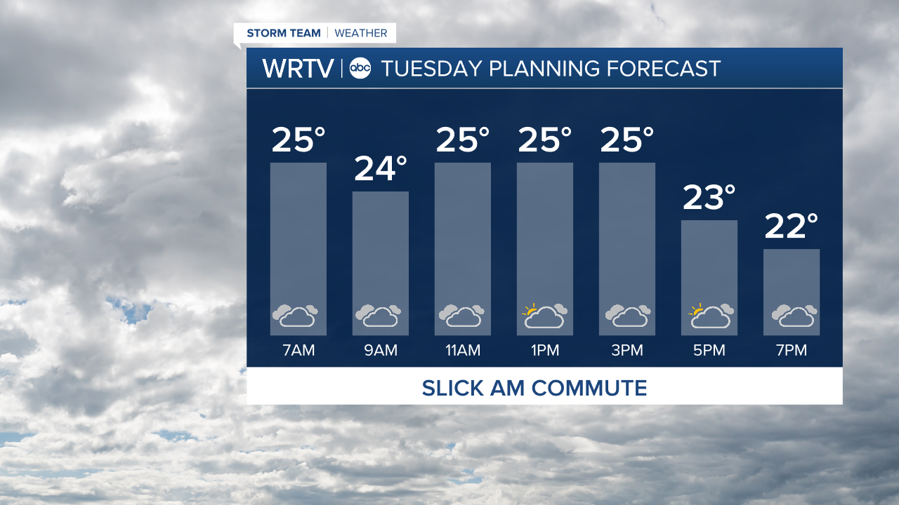
After the snow ends, it will be a cold and mostly cloudy day, although a few clouds may try to clear in the afternoon.
There could be a few snow showers Wednesday overnight, with additional snow chances possible Friday evening and overnight.
Temperatures stay below normal through the 7-Day Forecast, with Thursday and Thursday night looking the coolest.
Indianapolis Weather Forecast:
Overnight: Snow continues. Low: 24°
Tuesday: AM snow ending. Cloudy and cold. High: 28°
Wednesday: Partly sunny. Few PM snow showers. High: 35°
Indianapolis 7-Day Weather Forecast
WRTV
